Latitude: 51.1845 / 51°11'4"N
Longitude: 0.8198 / 0°49'11"E
OS Eastings: 597165
OS Northings: 146589
OS Grid: TQ971465
Mapcode National: GBR RW7.Q2P
Mapcode Global: VHKKF.5H89
Plus Code: 9F325RM9+RW
Entry Name: 4, 5, 6 and 7, Tutt Hill Lane
Listing Date: 10 October 1980
Grade: II
Source: Historic England
Source ID: 1071342
English Heritage Legacy ID: 181316
ID on this website: 101071342
Location: Tutt Hill, Ashford, Kent, TN26
County: Kent
District: Ashford
Civil Parish: Westwell
Built-Up Area: Ram Lane
Traditional County: Kent
Lieutenancy Area (Ceremonial County): Kent
Tagged with: Building
1. 5272 WESTWELL TUTT HILL LANE Tutt Hill Nos 4, 5, 6 and 7 TQ 97 NE 11/37
II
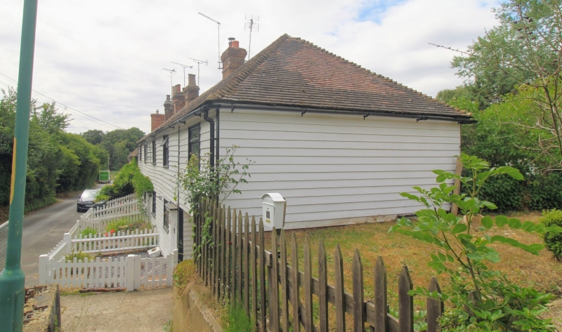
2. Early C19 range of cottages. Two storeys weatherboarded. Hipped tiled roof. Four windows in all, mainly altered casements. Simple doorcases with flat wooden weatherboards on brackets, except for No 7 which has an altered doorcase.
Listing NGR: TQ9716546589
External links are from the relevant listing authority and, where applicable, Wikidata. Wikidata IDs may be related buildings as well as this specific building. If you want to add or update a link, you will need to do so by editing the Wikidata entry.


Other nearby listed buildings