Latitude: 51.1725 / 51°10'20"N
Longitude: 0.7693 / 0°46'9"E
OS Eastings: 593684
OS Northings: 145114
OS Grid: TQ936451
Mapcode National: GBR RWC.HB2
Mapcode Global: VHKKD.9S1K
Plus Code: 9F325QC9+XP
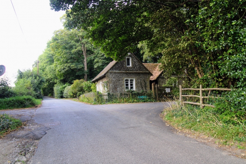
Entry Name: Gate Lodge to Former Surrenden Dering, About 250 Metres South West of Surrenden House
Listing Date: 10 October 1980
Grade: II
Source: Historic England
Source ID: 1071390
English Heritage Legacy ID: 181132
ID on this website: 101071390
Location: Ashford, Kent, TN27
County: Kent
District: Ashford
Civil Parish: Pluckley
Traditional County: Kent
Lieutenancy Area (Ceremonial County): Kent
Tagged with: Gatehouse
I. 5272 PLUCKLEY SURRENDEN PARK Gate Lodge to former Surrenden Dering, about 250 metres south-west of Surrenden House TQ 94 NW 10/420 II 2. Mid Cl9 lodge built of squared Kentish ragstone. One storey and attics. Tiled roof with clustered chimney stack. Gable end has band of bricks set diagonally and a blocked in lancet with a brick surround. Stepped kneelers. Double lancet to ground floor, with painted brick surround, which form the distinctive Dering windows. Simple doorcase.
Listing NGR: TQ9368445114
External links are from the relevant listing authority and, where applicable, Wikidata. Wikidata IDs may be related buildings as well as this specific building. If you want to add or update a link, you will need to do so by editing the Wikidata entry.


Other nearby listed buildings