Approximate Location Map
Large Map »
Latitude: 51.1525 / 51°9'9"N
Longitude: 0.6676 / 0°40'3"E
OS Eastings: 586655
OS Northings: 142635
OS Grid: TQ866426
Mapcode National: GBR QV3.MM5
Mapcode Global: VHJN2.J989
Plus Code: 9F325M39+22
Entry Name: Hadman's Place Farmhouse
Listing Date: 14 February 1967
Grade: II
Source: Historic England
Source ID: 1071403
English Heritage Legacy ID: 181163
ID on this website: 101071403
Location: Smarden Bell, Ashford, Kent, TN27
County: Kent
District: Ashford
Civil Parish: Smarden
Traditional County: Kent
Lieutenancy Area (Ceremonial County): Kent
Tagged with: Farmhouse
1.
5272 SMARDEN BELL LANE
TQ 8642 23/57 14.2.67 Hadman's Place Farmhouse
II
2.
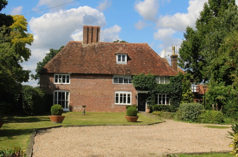
L-shaped building. The north-south wing is C17 or earlier timber-framed,
with the timbering and red brick infilling exposed in the north-east wall,
but refronted with red brick and grey headers. The west wing is probably a
C18 addition, in red brick. Two storeys and attics. Hipped tiled roof with
one hipped dormer. Three casement windows.
Listing NGR: TQ8665542635
External links are from the relevant listing authority and, where applicable, Wikidata. Wikidata IDs may be related buildings as well as this specific building. If you want to add or update a link, you will need to do so by editing the Wikidata entry.


Other nearby listed buildings
