Latitude: 51.142 / 51°8'31"N
Longitude: 0.8286 / 0°49'42"E
OS Eastings: 597960
OS Northings: 141884
OS Grid: TQ979418
Mapcode National: GBR RWV.6BN
Mapcode Global: VHKKM.9KXD
Plus Code: 9F324RRH+QC
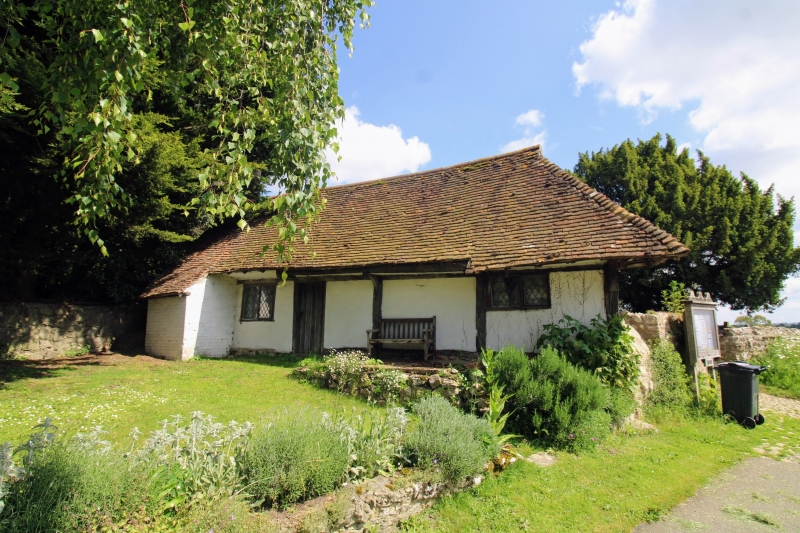
Entry Name: Timber Framed Building in the South West Corner of the Churchyard of Church of St Mary
Listing Date: 14 February 1967
Last Amended: 10 October 1980
Grade: II*
Source: Historic England
Source ID: 1071488
English Heritage Legacy ID: 180965
ID on this website: 101071488
Location: Great Chart, Ashford, Kent, TN23
County: Kent
District: Ashford
Civil Parish: Great Chart with Singleton
Built-Up Area: Ashford (Ashford)
Traditional County: Kent
Lieutenancy Area (Ceremonial County): Kent
Tagged with: Architectural structure
1. 5272 GREAT CHART THE STREET (north-west side) Timber-framed building in the south-west corner of the churchyard of Church of St Mary (formerly listed as Small Building in south-west corner of Church-yard) TQ 9741 24/1A 14.2.67. II* 2. C16 or earlier timber-framed building of one storey and 2 windows with plaster infilling, widely overhanging eaves on brackets with sprockets above and a hipped tiled roof. Two small red brick additions to the west. This building seems too small to have been the pre-Reformation priest-house and too old to have been intended for watching the churchyard. Its origin and purpose are uncertain, Sir Charles Igglesden, in his "Saunters through Kent with a Pen and Pencil", suggests that it was the pest-house, but its position makes this improbable.
Listing NGR: TQ9796041884
External links are from the relevant listing authority and, where applicable, Wikidata. Wikidata IDs may be related buildings as well as this specific building. If you want to add or update a link, you will need to do so by editing the Wikidata entry.


Other nearby listed buildings