Approximate Location Map
Large Map »
Latitude: 51.2 / 51°12'0"N
Longitude: 0.771 / 0°46'15"E
OS Eastings: 593687
OS Northings: 148185
OS Grid: TQ936481
Mapcode National: GBR RVZ.PQL
Mapcode Global: VHKKD.93YC
Plus Code: 9F326Q2C+29
Entry Name: Newlands Stud Farmhouse
Listing Date: 10 October 1980
Grade: II*
Source: Historic England
Source ID: 1071537
English Heritage Legacy ID: 180778
ID on this website: 101071537
Location: Ashford, Kent, TN27
County: Kent
District: Ashford
Civil Parish: Charing
Traditional County: Kent
Lieutenancy Area (Ceremonial County): Kent
Tagged with: Farmhouse
1.
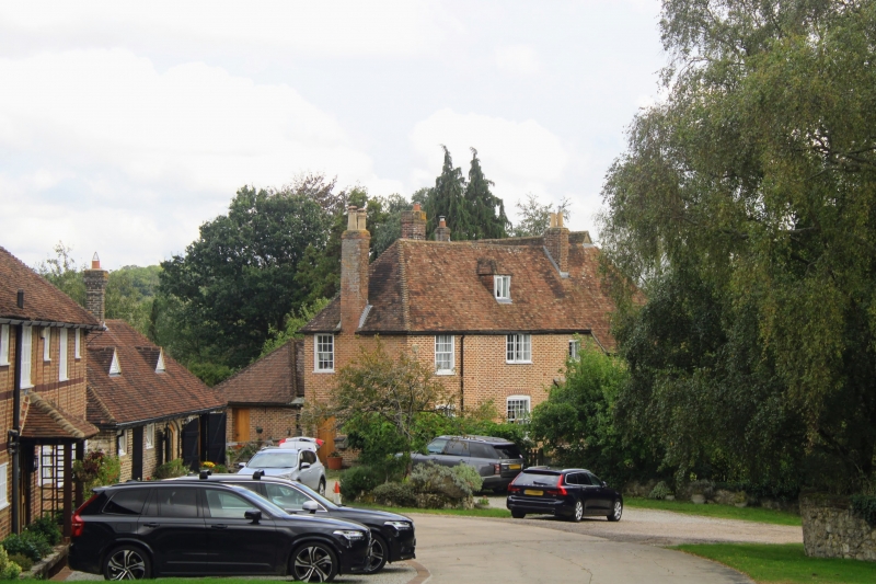
5272 CHARING NEWLANDS ROAD
Newlands Stud Farmhouse
TQ 94 NW 10/74
II* GV
2.
L-shaped timber-framed building, possibly dating from late Norman period, refronted
in C18. The exterior is of 2 storeys and attics. Red brick with grey headers.
Hipped tiled roof. Four sashes with glazing bars intact. Doorcase with flat
hood over. The east window bay projects. The interior has exposed curved
braces, roof with 2 crown posts and a moulded tie beam.
Listing NGR: TQ9357448172
External links are from the relevant listing authority and, where applicable, Wikidata. Wikidata IDs may be related buildings as well as this specific building. If you want to add or update a link, you will need to do so by editing the Wikidata entry.


Other nearby listed buildings
