Latitude: 54.1441 / 54°8'38"N
Longitude: -2.5972 / 2°35'49"W
OS Eastings: 361088
OS Northings: 472197
OS Grid: SD610721
Mapcode National: GBR BN9J.J6
Mapcode Global: WH952.23JC
Plus Code: 9C6V4CV3+M4
Entry Name: Wrayton Farmhouse
Listing Date: 4 October 1967
Grade: II
Source: Historic England
Source ID: 1071638
English Heritage Legacy ID: 182471
ID on this website: 101071638
Location: Wrayton, Lancaster, Lancashire, LA6
County: Lancashire
District: Lancaster
Civil Parish: Melling-with-Wrayton
Traditional County: Lancashire
Lieutenancy Area (Ceremonial County): Lancashire
Church of England Parish: Tunstall St John the Baptist and Melling St Wilfred and Leck St Peter
Church of England Diocese: Blackburn
Tagged with: Farmhouse
MELLING-WITH-WRAYTON WRAYTON SD 67 SW
5/173 Wrayton Farmhouse 4-10-1967 GV II
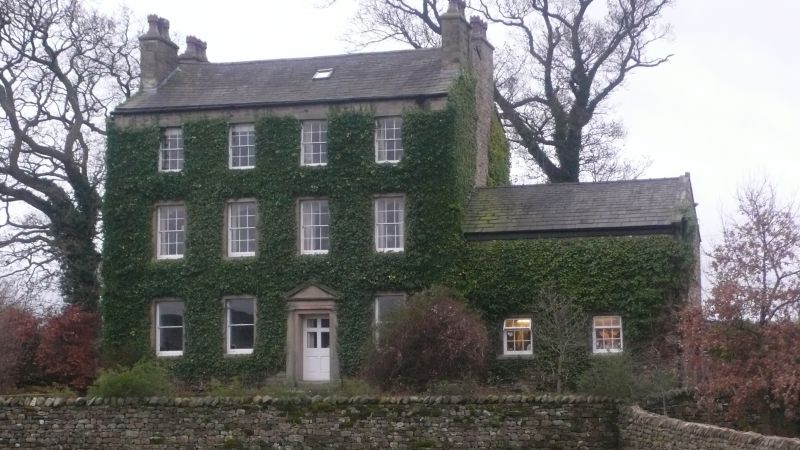
House, late C18th. Sandstone rubble with slate roof. 3 storeys, 4 bays, with chamfered quoins. Windows have plain stone surrounds and are sashed with glazing bars except for those on the ground floor, which are sashed with no glazing bars. The door, in the 3rd bay, has a Tuscan stone doorcase with triangular pediment. 2 chimneys on each gable. Inside, the right-hand front room has a built-in cupboard with round head and doors with raised and fielded panels, The stair has a closed string, slim turned newels and balusters,and a ramped handrail.
Listing NGR: SD6108872197
External links are from the relevant listing authority and, where applicable, Wikidata. Wikidata IDs may be related buildings as well as this specific building. If you want to add or update a link, you will need to do so by editing the Wikidata entry.


Other nearby listed buildings