Latitude: 54.1236 / 54°7'24"N
Longitude: -2.739 / 2°44'20"W
OS Eastings: 351798
OS Northings: 470000
OS Grid: SD517700
Mapcode National: GBR 9N9R.TK
Mapcode Global: WH83V.WMW4
Plus Code: 9C6V47F6+C9
Entry Name: Hall Farmhouse
Listing Date: 4 October 1967
Grade: II
Source: Historic England
Source ID: 1071870
English Heritage Legacy ID: 181909
ID on this website: 101071870
Location: Over Kellet, Lancaster, Lancashire, LA6
County: Lancashire
District: Lancaster
Civil Parish: Over Kellet
Built-Up Area: Over Kellet
Traditional County: Lancashire
Lieutenancy Area (Ceremonial County): Lancashire
Church of England Parish: Over Kellet St Cuthbert
Church of England Diocese: Blackburn
Tagged with: Farmhouse
SD 56 NW OVER KELLET KELLET ROAD SD 57 SW Hall Farmhouse 7/141 and 14/141 II 4. 10. 1967
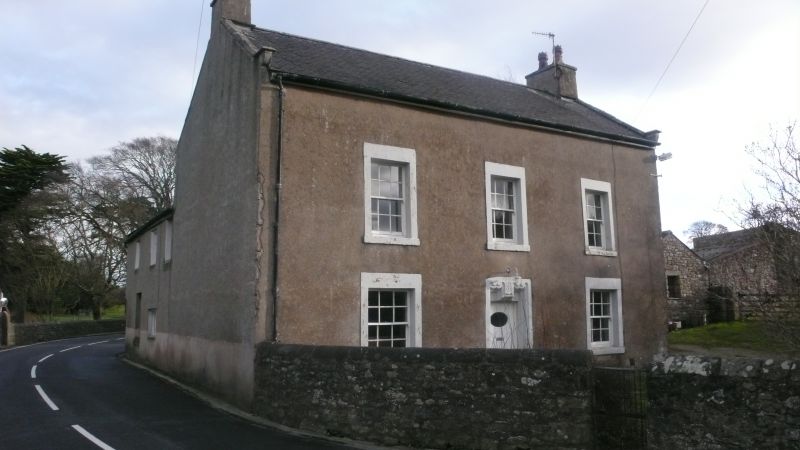
House, '1704 RGD' on lintel. Pebbledashed rubble with slate roof. T-plan with central entry and gable stacks. 2 storeys with attic, 3 bays. Windows sashed with glazing bars in plain stone surrounds. Door surround has deep moulding which continues around shaped lintel. Gables have copings and kneelers. Right-hand gable has a one-light chamfered attic window. Rear wing has the remains of rebated and chamfered window surrounds on both floors of the left-hand wall, facing the road. Interior said to be of interest.
Listing NGR: SD5179870000
External links are from the relevant listing authority and, where applicable, Wikidata. Wikidata IDs may be related buildings as well as this specific building. If you want to add or update a link, you will need to do so by editing the Wikidata entry.


Other nearby listed buildings