Latitude: 53.8716 / 53°52'17"N
Longitude: -2.3919 / 2°23'30"W
OS Eastings: 374330
OS Northings: 441786
OS Grid: SD743417
Mapcode National: GBR CRQN.YW
Mapcode Global: WH96B.7Y89
Plus Code: 9C5VVJC5+M7
Entry Name: 4-12, Castle Street
Listing Date: 30 September 1976
Grade: II
Source: Historic England
Source ID: 1072366
English Heritage Legacy ID: 182772
ID on this website: 101072366
Location: Clitheroe, Ribble Valley, Lancashire, BB7
County: Lancashire
District: Ribble Valley
Civil Parish: Clitheroe
Built-Up Area: Clitheroe
Traditional County: Lancashire
Lieutenancy Area (Ceremonial County): Lancashire
Church of England Parish: Clitheroe St Mary Magdalene
Church of England Diocese: Blackburn
Tagged with: Building
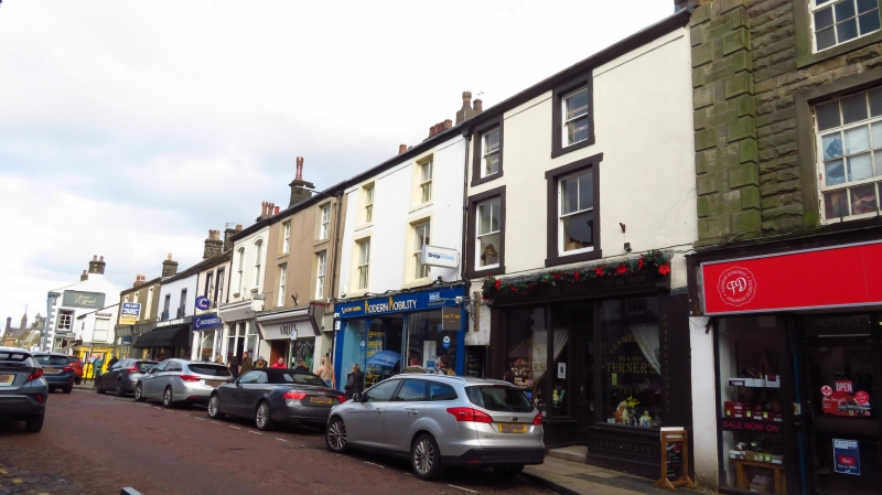
CASTLE STREET
1.
5295 (South-East Side)
-----------------
Nos 4 to 12 (even)
SD 7441 1/5
II GV
2.
C18 origins. 3 storeys, rendered, band and moulded eaves cornice. 2 windows to
3 occupancies, hung sashes with glazing bars, except for 1 to 1st floor. Modern
and late C19 shop fronts.
Nos 2 to 12 (even) form a group.
Listing NGR: SD7433041786
External links are from the relevant listing authority and, where applicable, Wikidata. Wikidata IDs may be related buildings as well as this specific building. If you want to add or update a link, you will need to do so by editing the Wikidata entry.


Other nearby listed buildings