Latitude: 53.8684 / 53°52'6"N
Longitude: -2.4176 / 2°25'3"W
OS Eastings: 372638
OS Northings: 441438
OS Grid: SD726414
Mapcode National: GBR CRKQ.D0
Mapcode Global: WH96H.T1Y6
Plus Code: 9C5VVH9J+9X
Entry Name: Edisford Bridge (That Part in Former MB of Clitheroe)
Listing Date: 19 May 1950
Grade: II
Source: Historic England
Source ID: 1072383
English Heritage Legacy ID: 182811
ID on this website: 101072383
Location: Low Moor, Ribble Valley, Lancashire, BB7
County: Lancashire
District: Ribble Valley
Civil Parish: Clitheroe
Traditional County: Lancashire
Lieutenancy Area (Ceremonial County): Lancashire
Church of England Parish: Clitheroe St Paul, Low Moor
Church of England Diocese: Blackburn
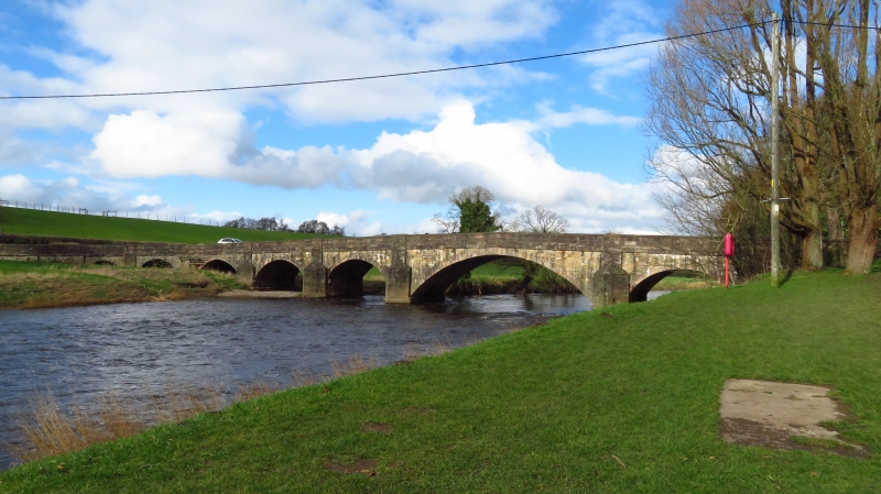
EDISFORD ROAD 1. 5295 Edisford Bridge (that part in the former M B of Clitheroe) SD 74 SW 7/38 19.5.50. II 2. An ancient bridge of 4 arches with cutwaters. The main arch is segmental and of considerably greater space than the other 3 which are pointed mediaeval arches with 3 ribs. The bridge was widened from about 8 ft to about 20 ft.
Listing NGR: SD7263841438


Other nearby listed buildings