Approximate Location Map
Large Map »
Latitude: 51.2731 / 51°16'23"N
Longitude: 0.3203 / 0°19'13"E
OS Eastings: 561951
OS Northings: 155217
OS Grid: TQ619552
Mapcode National: GBR NPM.3ST
Mapcode Global: VHHPV.H8QD
Plus Code: 9F3278FC+64
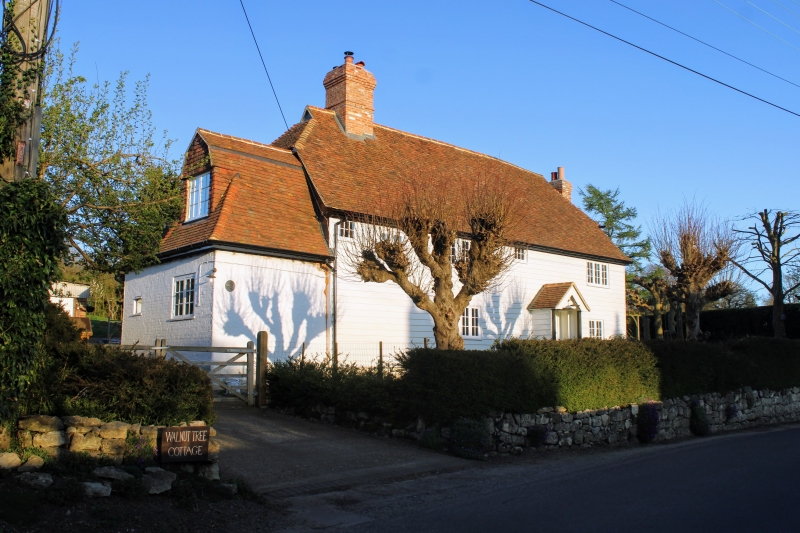
Entry Name: Walnut Tree Cottage
Listing Date: 3 May 1984
Grade: II
Source: Historic England
Source ID: 1072689
English Heritage Legacy ID: 357345
ID on this website: 101072689
Location: Crouch, Tonbridge and Malling, Kent, TN15
County: Kent
District: Tonbridge and Malling
Civil Parish: Plaxtol
Traditional County: Kent
Lieutenancy Area (Ceremonial County): Kent
Church of England Parish: Platt St Mary the Virgin
Church of England Diocese: Rochester
Tagged with: Cottage
TQ 65 NW PLAXTOL LONG MILL LANE
2/37 (east side)
Walnut Tree Cottage
II
Cottage. Later elevation to C17 framed structure. Weather-boarded. Half-hipped
plain tiled roof with gablets. Roughcast end stack to right and ridge stack to left.
Two storeys; irregular 3 windows, casements. Half-glazed and panelled door with
projecting gabled and tiled porch.
Listing NGR: TQ6195155217
External links are from the relevant listing authority and, where applicable, Wikidata. Wikidata IDs may be related buildings as well as this specific building. If you want to add or update a link, you will need to do so by editing the Wikidata entry.


Other nearby listed buildings
