Latitude: 53.4081 / 53°24'29"N
Longitude: -2.9677 / 2°58'3"W
OS Eastings: 335770
OS Northings: 390576
OS Grid: SJ357905
Mapcode National: GBR 78N.19
Mapcode Global: WH877.DL2N
Plus Code: 9C5VC25J+6W
Entry Name: Royal Infirmary (Waterhouse Building Only)
Listing Date: 14 March 1975
Grade: II
Source: Historic England
Source ID: 1072993
English Heritage Legacy ID: 359226
ID on this website: 101072993
Location: Liverpool, Merseyside, L69
County: Liverpool
Electoral Ward/Division: Central
Parish: Non Civil Parish
Built-Up Area: Liverpool
Traditional County: Lancashire
Lieutenancy Area (Ceremonial County): Merseyside
Church of England Parish: St Luke in the City Team
Church of England Diocese: Liverpool
Tagged with: Building
SJ 3590 NE PEMBROKE PLACE L3 51/884 Royal Infirmary (Waterhouse Building only) 14.3.75. - II
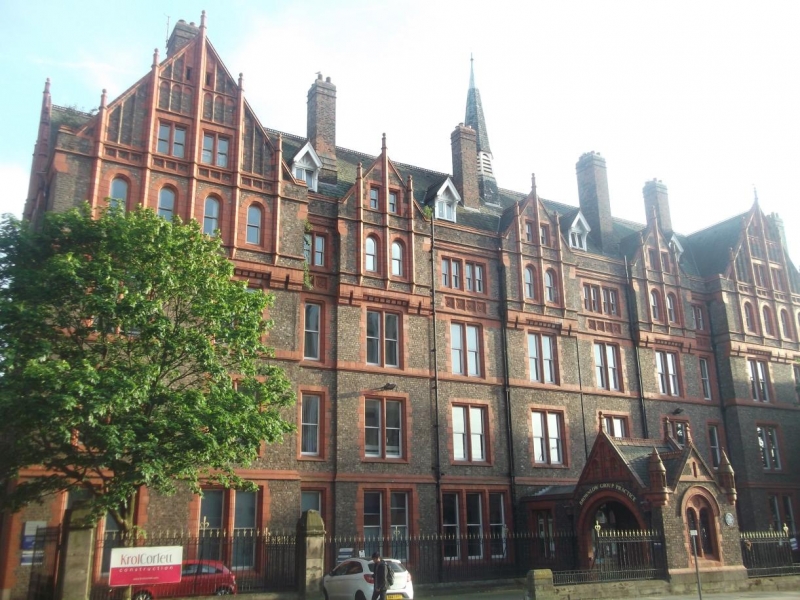
Hospital. 1887-90. A.Waterhouse. Common brick with red brick and terracotta dressings, slate roof. Symmetrical front of 4 storeys and attic, 11 bays. 2 bays at each end project; of the centre bays 3 break forward, all under gables. Windows are mostly paired and are sashed without glazing bars; top floor windows smaller and round- headed. 4 wooden, gabled dormers and 3 tall brick stacks. Ventilating spire on ridge has louvred openings. Porte cochere has round relieving arch containing 2 round headed lights with iron grilles and blind roundel, gable flanked by pinnacles over. Returns have round arches under gables. Chapel has aisles with round columns and round arches and a 3-sided apse, all entirely covered with patterned green, grey and blue tiles.
Listing NGR: SJ3577090576
External links are from the relevant listing authority and, where applicable, Wikidata. Wikidata IDs may be related buildings as well as this specific building. If you want to add or update a link, you will need to do so by editing the Wikidata entry.


Other nearby listed buildings