Latitude: 52.6697 / 52°40'10"N
Longitude: -0.7305 / 0°43'49"W
OS Eastings: 485939
OS Northings: 308756
OS Grid: SK859087
Mapcode National: GBR CRL.N3G
Mapcode Global: WHFKN.R595
Plus Code: 9C4XM799+VQ
Entry Name: 64, High Street
Listing Date: 24 November 1971
Grade: II
Source: Historic England
Source ID: 1073314
English Heritage Legacy ID: 186478
ID on this website: 101073314
Location: Oakham, Rutland, LE15
County: Rutland
Civil Parish: Oakham
Built-Up Area: Oakham
Traditional County: Rutland
Lieutenancy Area (Ceremonial County): Rutland
Church of England Parish: Oakham All Saints
Church of England Diocese: Peterborough
Tagged with: Building
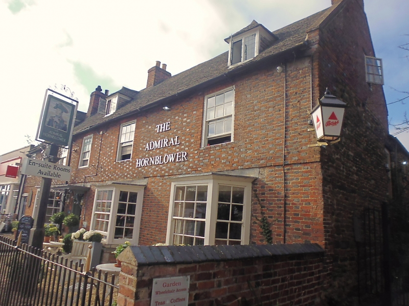
HIGH STREET
1.
1469
(South Side)
No 64
SK 8508 6/50
II
2.
C18. Red and blue chequered brick. Stone slate roof, 3 hipped
dormers. Stone band. Moulded wood eaves cornice. 2-storeys and
attics. 7 windows, partly concealed by ivy, in flush frames with
straight brick arches. Ground floor has 3 bays with contemporary
windows and one modern window and door on East side. Modern door
with small wood porch.
Listing NGR: SK8593908756
External links are from the relevant listing authority and, where applicable, Wikidata. Wikidata IDs may be related buildings as well as this specific building. If you want to add or update a link, you will need to do so by editing the Wikidata entry.


Other nearby listed buildings