Approximate Location Map
Large Map »
Latitude: 53.8789 / 53°52'43"N
Longitude: -2.1707 / 2°10'14"W
OS Eastings: 388876
OS Northings: 442532
OS Grid: SD888425
Mapcode National: GBR FR8L.V8
Mapcode Global: WHB7K.MRKR
Plus Code: 9C5VVRHH+GP
Entry Name: Canal House
Listing Date: 29 January 1988
Grade: II
Source: Historic England
Source ID: 1073360
English Heritage Legacy ID: 186292
ID on this website: 101073360
Location: Foulridge, Pendle, Lancashire, BB8
County: Lancashire
District: Pendle
Civil Parish: Foulridge
Built-Up Area: Foulridge
Traditional County: Lancashire
Lieutenancy Area (Ceremonial County): Lancashire
Church of England Parish: Foulridge St Michael and All Angels
Church of England Diocese: Blackburn
Tagged with: House
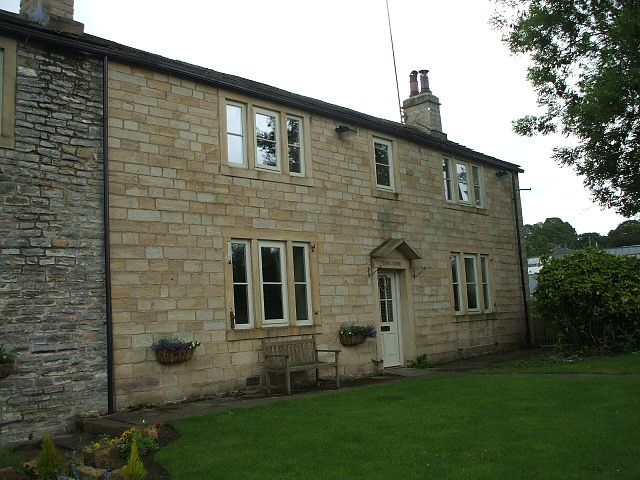
SD 84 SE FOULRIDGE WAREHOUSE LANE
7/137 Canal House
GV II
House. Late C18. Stone, stone slate roof. 2 storeys. Symmetrical about plain
doorway with peaked stone hood. Two 3-light sash windows to each floor, one
single light sash window above door. All mullions lintels and jambs are flat.
Listing NGR: SD8887642532
External links are from the relevant listing authority and, where applicable, Wikidata. Wikidata IDs may be related buildings as well as this specific building. If you want to add or update a link, you will need to do so by editing the Wikidata entry.


Other nearby listed buildings
