Latitude: 53.3989 / 53°23'55"N
Longitude: -2.9676 / 2°58'3"W
OS Eastings: 335759
OS Northings: 389550
OS Grid: SJ357895
Mapcode National: GBR 78R.1L
Mapcode Global: WH877.DT2R
Plus Code: 9C5V92XJ+GX
Entry Name: 16, 18 and 20, St Bride Street
Listing Date: 19 June 1985
Grade: II
Source: Historic England
Source ID: 1073502
English Heritage Legacy ID: 359388
ID on this website: 101073502
Location: Liverpool, Merseyside, L8
County: Liverpool
Electoral Ward/Division: Princes Park
Parish: Non Civil Parish
Built-Up Area: Liverpool
Traditional County: Lancashire
Lieutenancy Area (Ceremonial County): Merseyside
Church of England Parish: St Luke in the City Team
Church of England Diocese: Liverpool
Tagged with: Building
SJ 3589 NE ST. BRIDE STREET (west side) L8
57/ Nos. 16, 18, - 20
G.V. II
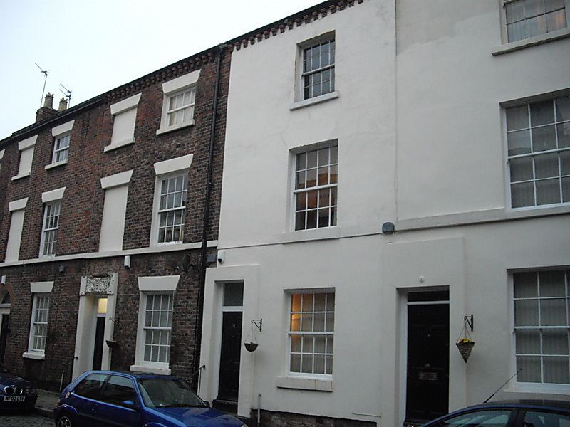
3 houses. 1830's. Brick with stone dressings, Nos. 16 and 18 now rendered, slate roof. 3 storeys, one bay to each house. Stone base and 1st floor sill band; top brick corbels supporting gutter. Windows are sashed with glazing bars. Simple rendered doorcases and 6-panel doors with overlights. No. 20 has wedge lintels to windows and a blind window to each floor above the entrance, which has panel with 2 acanthus motifs in lintel.
Listing NGR: SJ3575989550
External links are from the relevant listing authority and, where applicable, Wikidata. Wikidata IDs may be related buildings as well as this specific building. If you want to add or update a link, you will need to do so by editing the Wikidata entry.


Other nearby listed buildings