Latitude: 52.6865 / 52°41'11"N
Longitude: -0.6963 / 0°41'46"W
OS Eastings: 488219
OS Northings: 310664
OS Grid: SK882106
Mapcode National: GBR CRF.JS0
Mapcode Global: WHGLM.8QNT
Plus Code: 9C4XM8P3+HF
Entry Name: The Smithy
Listing Date: 18 September 1984
Grade: II
Source: Historic England
Source ID: 1073757
English Heritage Legacy ID: 187301
ID on this website: 101073757
Location: Burley, Rutland, LE15
County: Rutland
Civil Parish: Burley
Traditional County: Rutland
Lieutenancy Area (Ceremonial County): Rutland
Church of England Parish: Cottesmore, Barrow St Nicholas
Church of England Diocese: Peterborough
Tagged with: Smithy
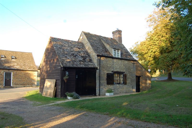
SK 81 SE BURLEY THE GREEN
3/18 The Smithy
II
Small cottage on green, C18. Coursed rubble with angle quoins and stone
tiled roof. 1½ storeys, single unit plan, with single shuttered window
with flat timber lintel to ground floor and a dormer above. Doorway in
small lean-to to right. Small boarded barn to left, presumably the forge
itself.
Listing NGR: SK8821910664
External links are from the relevant listing authority and, where applicable, Wikidata. Wikidata IDs may be related buildings as well as this specific building. If you want to add or update a link, you will need to do so by editing the Wikidata entry.


Other nearby listed buildings