Latitude: 53.7277 / 53°43'39"N
Longitude: -2.6822 / 2°40'55"W
OS Eastings: 355089
OS Northings: 425921
OS Grid: SD550259
Mapcode National: GBR 9TQB.3F
Mapcode Global: WH85T.RKZL
Plus Code: 9C5VP8H9+34
Entry Name: Pickerings Farmhouse
Listing Date: 2 September 1983
Grade: II
Source: Historic England
Source ID: 1074112
English Heritage Legacy ID: 358041
ID on this website: 101074112
Location: Tardy Gate, South Ribble, Lancashire, PR5
County: Lancashire
District: South Ribble
Electoral Ward/Division: Lostock Hall
Parish: Non Civil Parish
Built-Up Area: Bamber Bridge
Traditional County: Lancashire
Lieutenancy Area (Ceremonial County): Lancashire
Church of England Parish: Lostock Hall St James
Church of England Diocese: Blackburn
Tagged with: Farmhouse
SD 52NE WALTON LE DALE TODD LANE NORTH
5/136 Pickerings Farmhouse 2.9.1983 GV II
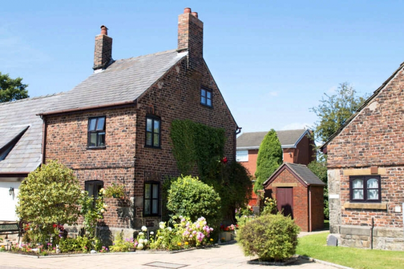
Farmhouse, C17 or earlier, with late C18 extension (which is higher), now 2 cottages. Brick on stone plinth, part rendered, roof on 2 levels; the first is of corrugated iron covering thatch, the other is of slate at front, stone slates at rear, and has 2 gable chimneys. The earlier building is 2-bay baffle-entry plan, 1½ storeys, cruck-framed and clad in brick rendered at the front and left end; this has a door at right end of 2nd bay, an upper window breaking the eaves to the left of the door, and 2 ground floor windows, all sliding sashes; a similar window on each floor of the left end wall (which is buttressed), and 3 others in the rear wall. Low outshut to rear of 2nd bay. Extension at right end is one bay, double pile, 2 storeys with an attic; door on the left, one casement window on each floor; right end wall has one ground floor window and an attic window, rear has one window on each floor and a stairlight window offset to the right. Interior: cruck blades visible in the earlier building, and inglenook with bressummer in 2nd bay.
Listing NGR: SD5508925921
External links are from the relevant listing authority and, where applicable, Wikidata. Wikidata IDs may be related buildings as well as this specific building. If you want to add or update a link, you will need to do so by editing the Wikidata entry.


Other nearby listed buildings