Latitude: 52.7103 / 52°42'36"N
Longitude: -1.1768 / 1°10'36"W
OS Eastings: 455709
OS Northings: 312827
OS Grid: SK557128
Mapcode National: GBR 8LM.395
Mapcode Global: WHDJ3.W4SL
Plus Code: 9C4WPR6F+47
Entry Name: Gazebo, Walls and Outhouse on Corner of Road at Hall Farm
Listing Date: 1 June 1966
Grade: II
Source: Historic England
Source ID: 1074655
English Heritage Legacy ID: 189126
ID on this website: 101074655
Location: Swithland, Charnwood, Leicestershire, LE12
County: Leicestershire
District: Charnwood
Civil Parish: Swithland
Traditional County: Leicestershire
Lieutenancy Area (Ceremonial County): Leicestershire
Church of England Parish: Swithland St Leonard
Church of England Diocese: Leicester
Tagged with: Gazebo
SWITHLAND MAIN STREET (North Side) SK 51 SE 4/70 Gazebo, Walls and Outhouse on Corner of Road at Hall Farm 1.6.66 (Gazebo) GV II
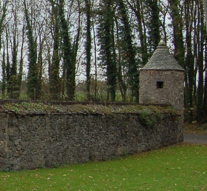
Gazebo, or lock-up, and walls probably of C18, with C19 outhouse. Gazebo of granite and slate rubble stone with pointed Swithland slate roof. Small circular tower of 2 storeys. Door in base and door, small 1-light openings and tiny slits above. Generally said locally to be a lock-up but as there is a pair at opposite ends of site of Old Swithland Hall, it is more likely that they are folly boundary towers or gazebos. 2 granite and slate rubble stone walls c3m high extend from gazebo at right angles to each other to stable (listed separately) and barn of 1750 (listed separately). Attached to wall near this barn is an outhouse with brick piers and Swithland slate roof.
Listing NGR: SK5570912827
External links are from the relevant listing authority and, where applicable, Wikidata. Wikidata IDs may be related buildings as well as this specific building. If you want to add or update a link, you will need to do so by editing the Wikidata entry.


Other nearby listed buildings