Latitude: 51.0738 / 51°4'25"N
Longitude: 1.1474 / 1°8'50"E
OS Eastings: 620577
OS Northings: 135205
OS Grid: TR205352
Mapcode National: GBR V0P.NWL
Mapcode Global: FRA F698.SZH
Plus Code: 9F3334FW+GW
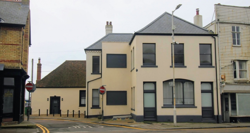
Entry Name: Former Fleur De Lis Public House
Listing Date: 11 March 1975
Grade: II
Source: Historic England
Source ID: 1075167
English Heritage Legacy ID: 175346
ID on this website: 101075167
Location: Sandgate, Folkestone and Hythe, Kent, CT20
County: Kent
District: Folkestone and Hythe
Civil Parish: Sandgate
Built-Up Area: Folkestone
Traditional County: Kent
Lieutenancy Area (Ceremonial County): Kent
Tagged with: Pub
This list entry was subject to a Minor Amendment on 10 April 2025 to amend the name and address and reformat the text to current standards.
TR 2035 SE
7/150
SANDGATE
SANDGATE HIGH STREET (south side)
No 23, Former Fleur de Lis Public House
(Formerly listed as No 23 (Fleur de Lis Public House) HIGH STREET)
II
GV
Mid C19. Two storeys stuccoed. Hipped slate roof. Three sashes without glazing bars. The ground floor has a central three-light cambered window and two doorcases with rectangular fanlights. The rear part is reputed to have been the office for paying the troops engaged in building Sandgate Castle circa 1540, one storey stuccoed. Hipped old tiled roof with end chimneybreast. Sash windows with verticals only. Group value with Nos 25 to 29 (odd ).
Nos 23 to 39 (odd) form a group with Cottage to rear of No 39, Nos 41 to 65 (odd) including 43A, 45A and 55A and 61. (Nos 31 to 37 are buildings of local interest).
Listing NGR: TR2057735205
External links are from the relevant listing authority and, where applicable, Wikidata. Wikidata IDs may be related buildings as well as this specific building. If you want to add or update a link, you will need to do so by editing the Wikidata entry.


Other nearby listed buildings