Approximate Location Map
Large Map »
Latitude: 53.4798 / 53°28'47"N
Longitude: -2.932 / 2°55'55"W
OS Eastings: 338241
OS Northings: 398522
OS Grid: SJ382985
Mapcode National: GBR 7XZ6.09
Mapcode Global: WH86V.XSYP
Plus Code: 9C5VF3H9+W5
Entry Name: 5, 6 and 7, Mill Square
Listing Date: 17 January 1986
Grade: II
Source: Historic England
Source ID: 1075883
English Heritage Legacy ID: 216403
ID on this website: 101075883
Location: Aintree, Sefton, Merseyside, L10
County: Sefton
Civil Parish: Aintree Village
Built-Up Area: Liverpool
Traditional County: Lancashire
Lieutenancy Area (Ceremonial County): Merseyside
Church of England Parish: Aintree St Giles with St Peter
Church of England Diocese: Liverpool
Tagged with: Building
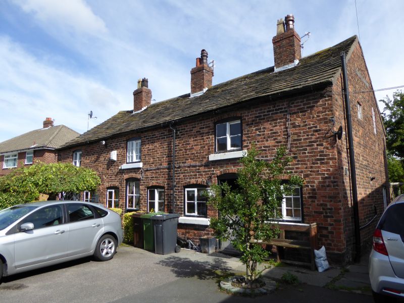
AINTREE MILL SQUARE
SJ 39 NW
(east side)
10/4 Nos. 5, 6, and 7
G.V. II
Houses. Late C18. Brick with stone slate roof. 2 storeys,
3 bays to each house. Each house has central segmental-
headed entrance with flanking ground floor windows and 1st
floor window above, all with segmental heads and 2-light
horizontally sliding sashes. 3 cross-axial stacks.
Listing NGR: SJ3824198522
External links are from the relevant listing authority and, where applicable, Wikidata. Wikidata IDs may be related buildings as well as this specific building. If you want to add or update a link, you will need to do so by editing the Wikidata entry.


Other nearby listed buildings
