Latitude: 52.4081 / 52°24'29"N
Longitude: -1.5251 / 1°31'30"W
OS Eastings: 432405
OS Northings: 279010
OS Grid: SP324790
Mapcode National: GBR H9M.YR
Mapcode Global: VHBWY.JQ4S
Plus Code: 9C4WCF5F+7X
Entry Name: Spon Bridge
Listing Date: 5 February 1955
Grade: II
Source: Historic England
Source ID: 1076603
English Heritage Legacy ID: 218572
ID on this website: 101076603
Location: Spon End, Coventry, West Midlands, CV1
County: Coventry
Electoral Ward/Division: Sherbourne
Parish: Non Civil Parish
Built-Up Area: Coventry
Traditional County: Warwickshire
Lieutenancy Area (Ceremonial County): West Midlands
Church of England Parish: Coventry St John Baptist
Church of England Diocese: Coventry
Tagged with: Bridge
1.
5105 SPON STREET
-----------
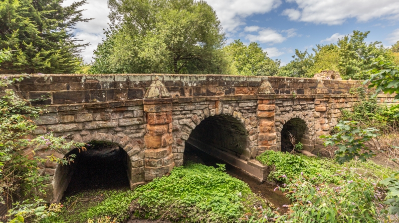
Spon Bridge
SP 3279 SW 7/80 5.2.55.
II GV
2.
C13, rebuilt 1771. Some stone from Spon Gate. Sandstone, 5 bays, pairs of plain
columns either end.
All the listed buildings in Spon Street form a group.
Listing NGR: SP3240579010
External links are from the relevant listing authority and, where applicable, Wikidata. Wikidata IDs may be related buildings as well as this specific building. If you want to add or update a link, you will need to do so by editing the Wikidata entry.


Other nearby listed buildings