Approximate Location Map
Large Map »
Latitude: 52.3883 / 52°23'17"N
Longitude: -1.734 / 1°44'2"W
OS Eastings: 418197
OS Northings: 276727
OS Grid: SP181767
Mapcode National: GBR 4JG.6FG
Mapcode Global: VH9ZK.W7NH
Plus Code: 9C4W97Q8+89
Entry Name: 1711 and 1713, Warwick Road
Listing Date: 22 July 1976
Grade: II
Source: Historic England
Source ID: 1076704
English Heritage Legacy ID: 218327
ID on this website: 101076704
Location: Knowle, Solihull, West Midlands, B93
County: Solihull
Electoral Ward/Division: Knowle
Parish: Non Civil Parish
Built-Up Area: Solihull
Traditional County: Warwickshire
Lieutenancy Area (Ceremonial County): West Midlands
Church of England Parish: Knowle
Church of England Diocese: Birmingham
Tagged with: Building
SOLIHULL KNOWLE
1.
5108
(High Street)
WARWICK ROAD
(North-East Side)
Nos 1711 and 1715
SP 1876 20/422
II Gi
2.
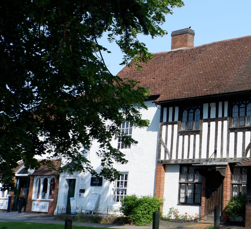
C18 remodelling of end of Cl5 Guild House. Colour washed roughcast, old tiled roof
with painted brick corbelled cornice. 2 storeys, sash windows with glazing bars.
6 panel door in surround with open pediment.
Nos 1709 -to 1715 (odd) form a group.
Listing NGR: SP1819776727
External links are from the relevant listing authority and, where applicable, Wikidata. Wikidata IDs may be related buildings as well as this specific building. If you want to add or update a link, you will need to do so by editing the Wikidata entry.


Other nearby listed buildings
