Latitude: 52.4125 / 52°24'45"N
Longitude: -1.7775 / 1°46'39"W
OS Eastings: 415230
OS Northings: 279414
OS Grid: SP152794
Mapcode National: GBR 4J0.MFZ
Mapcode Global: VH9ZC.4MNF
Plus Code: 9C4WC67C+2X
Entry Name: 124, High Street
Listing Date: 22 July 1976
Grade: II
Source: Historic England
Source ID: 1076718
English Heritage Legacy ID: 218260
ID on this website: 101076718
Location: Solihull, West Midlands, B91
County: Solihull
Electoral Ward/Division: St Alphege
Parish: Non Civil Parish
Built-Up Area: Solihull
Traditional County: Warwickshire
Lieutenancy Area (Ceremonial County): West Midlands
Church of England Parish: Solihull
Church of England Diocese: Birmingham
Tagged with: Building
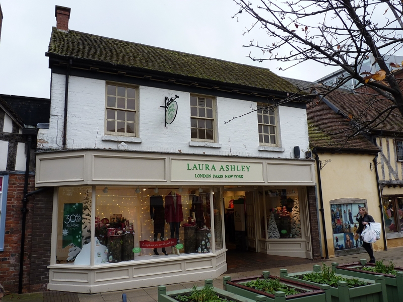
SOLIHULL HIGH STREET
1.
5108
(South-West Side)
No 124
SP 1579 1/459
II GV
2.
Early C19 painted brick front. Low pitched machine tiled roof with bracketed cornice.
2 storeys, 3 1st floor sash windows with glazing bars. Modern shop front with projecting
fascia.
Nos 116 to 120 (even), 124, 126, 130, 134, 138, 140, 142, and 144 form a group.
Listing NGR: SP1522179408
External links are from the relevant listing authority and, where applicable, Wikidata. Wikidata IDs may be related buildings as well as this specific building. If you want to add or update a link, you will need to do so by editing the Wikidata entry.


Other nearby listed buildings