Latitude: 52.6908 / 52°41'27"N
Longitude: 0.5389 / 0°32'19"E
OS Eastings: 571684
OS Northings: 313375
OS Grid: TF716133
Mapcode National: GBR P60.C1M
Mapcode Global: WHKQM.7MVH
Plus Code: 9F42MGRQ+8G
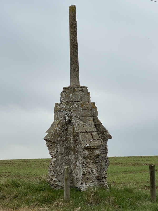
Entry Name: Remains of Cross at TF7168 1336
Listing Date: 14 October 1951
Last Amended: 20 June 1988
Grade: II
Source: Historic England
Source ID: 1077624
English Heritage Legacy ID: 222006
ID on this website: 101077624
Location: King's Lynn and West Norfolk, Norfolk, PE32
County: Norfolk
District: King's Lynn and West Norfolk
Civil Parish: Pentney
Traditional County: Norfolk
Lieutenancy Area (Ceremonial County): Norfolk
Church of England Parish: Pentney
Church of England Diocese: Norwich
PENTNEY ABBEY ROAD TF 71 SW 10/73 Remains of Cross at TF 7168 1336 (formerly 14.10.51 listed as Wayside Cross, Ashwood Farm) - II Wayside cross, C14. Limestone and small iron stained flint. Cruciform base of four buttresses each with limestone cap starting c.1.5m above ground. c.2.5m of octagonal limestone shaft. Cross is 2km east-north-east of Augustinian Priory q.v. 10/71. Scheduled Ancient Monument, Norfolk 186.
Listing NGR: TF7168413375


Other nearby listed buildings