Approximate Location Map
Large Map »
Latitude: 51.9763 / 51°58'34"N
Longitude: -3.016 / 3°0'57"W
OS Eastings: 330311
OS Northings: 231361
OS Grid: SO303313
Mapcode National: GBR F5.KQHS
Mapcode Global: VH78F.NLY9
Plus Code: 9C3RXXGM+GJ
Entry Name: Cross Approximately 5 Metres South of Church of St Peter
Listing Date: 14 March 1986
Grade: II
Source: Historic England
Source ID: 1078174
English Heritage Legacy ID: 355334
ID on this website: 101078174
Location: St Beuno's Church, Llanveynoe, County of Herefordshire, HR2
County: County of Herefordshire
Civil Parish: Llanveynoe
Traditional County: Herefordshire
Lieutenancy Area (Ceremonial County): Herefordshire
Church of England Parish: Llanveynoe
Church of England Diocese: Hereford
Tagged with: Building
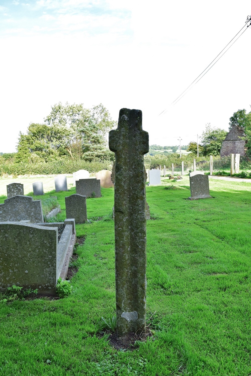
SO 33 SW LLANVEYNOE CP -
3/25 Cross approximately
5 m south of Church
of St Peter
GV II
Cross. Possibly C14. Sandstone ashlar. Square shaft with primitive cross.
Listing NGR: SO3031131361
External links are from the relevant listing authority and, where applicable, Wikidata. Wikidata IDs may be related buildings as well as this specific building. If you want to add or update a link, you will need to do so by editing the Wikidata entry.


Other nearby listed buildings
