Approximate Location Map
Large Map »
Latitude: 51.9532 / 51°57'11"N
Longitude: -2.9809 / 2°58'51"W
OS Eastings: 332682
OS Northings: 228752
OS Grid: SO326287
Mapcode National: GBR F7.M178
Mapcode Global: VH78N.85YJ
Plus Code: 9C3VX239+7J
Entry Name: Pontynys Bridge
Listing Date: 14 March 1986
Grade: II
Source: Historic England
Source ID: 1078190
English Heritage Legacy ID: 355375
ID on this website: 101078190
Location: Longtown, County of Herefordshire, HR2
County: County of Herefordshire
Civil Parish: Longtown
Traditional County: Herefordshire
Lieutenancy Area (Ceremonial County): Herefordshire
Church of England Parish: Clodock and Longtown
Church of England Diocese: Hereford
Tagged with: Bridge
SO 32 NW LONGTOWN CP -
6/66 Pontynys Bridge
- II
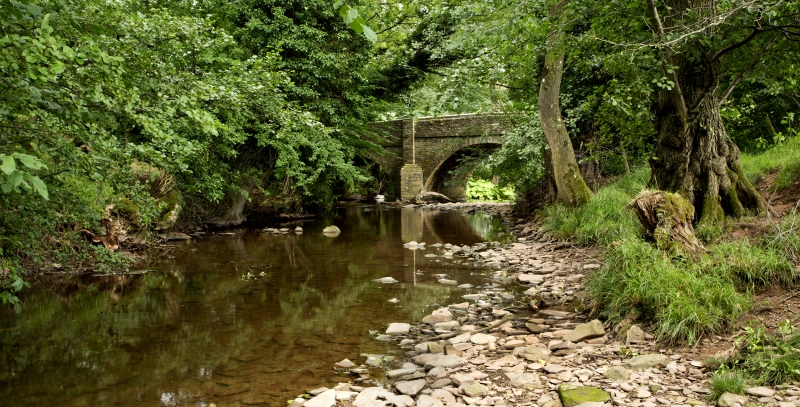
Shown on OS map as Pont-yr-ynys.
Bridge over River Monnow. Early C19. Sandstone rubble with sandstone
ashlar dressings. Three spans over river with cutwaters rising to plain
pilasters.
Listing NGR: SO3268228752
External links are from the relevant listing authority and, where applicable, Wikidata. Wikidata IDs may be related buildings as well as this specific building. If you want to add or update a link, you will need to do so by editing the Wikidata entry.


Other nearby listed buildings
