Approximate Location Map
Large Map »
Latitude: 51.6388 / 51°38'19"N
Longitude: -0.0878 / 0°5'16"W
OS Eastings: 532423
OS Northings: 195060
OS Grid: TQ324950
Mapcode National: GBR H6.DJG
Mapcode Global: VHGQF.F2GK
Plus Code: 9C3XJWQ6+GV
Entry Name: Clarendon Arch and Tunnel
Listing Date: 31 January 1974
Grade: II
Source: Historic England
Source ID: 1078903
English Heritage Legacy ID: 200558
ID on this website: 101078903
Location: Bush Hill Park, Enfield, London, N21
County: London
District: Enfield
Electoral Ward/Division: Grange
Parish: Non Civil Parish
Built-Up Area: Enfield
Traditional County: Middlesex
Lieutenancy Area (Ceremonial County): Greater London
Church of England Parish: St Peter Grange Park
Church of England Diocese: London
Tagged with: Building
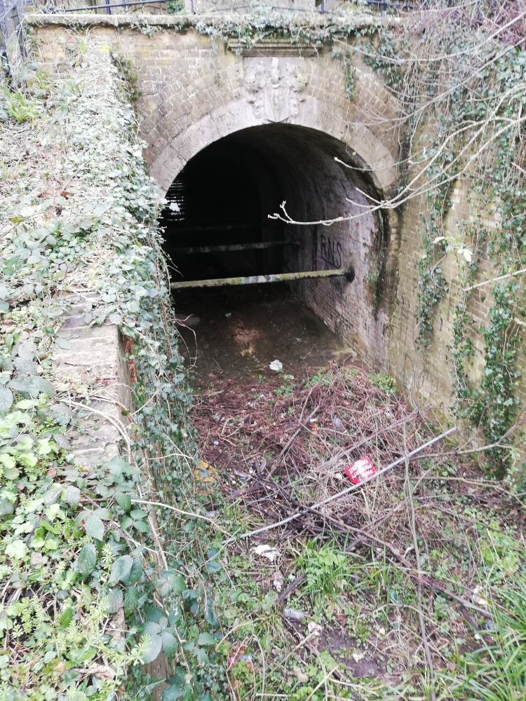
1.
4411 BUSH HILL N21
Clarendon Arch
and Tunnel
TQ 3295 8/53
II
2.
Bears inscription. "This arch was rebuilt in the year 1682. Honerable Henry
Earle of Clarendon Being Gov." Long tunnel over canal, barrel vaulted brick,
mostly pinky-yellow stock brick, probably early Cl9. The arch ring at one end
is of Portland stone, inscribed as above with a fine shield of arms with mantling
helm and crest of Myddelton. Capping over plain parapet. Historical interest.
The tunnel carries the Salmons Brook beneath the New River. Above tunnel on north-
west side a stone with inscription: "This bank of earth was raised and formed
to support the Channel of the New River. And the frame of timber and lead which
served that purpose 173 years was removed and taken away. MDCCLXXXVI Peter Holford
Esquire, Governor." These are part of the works of the New River, founded in
1613 by Sir Hugh Myddelton in order to bring a purer water supply to London.
Listing NGR: TQ3242395060
External links are from the relevant listing authority and, where applicable, Wikidata. Wikidata IDs may be related buildings as well as this specific building. If you want to add or update a link, you will need to do so by editing the Wikidata entry.


Other nearby listed buildings
