Latitude: 51.6264 / 51°37'35"N
Longitude: -0.0658 / 0°3'57"W
OS Eastings: 533977
OS Northings: 193729
OS Grid: TQ339937
Mapcode National: GBR J2.035
Mapcode Global: VHGQF.TD10
Plus Code: 9C3XJWGM+HM
Entry Name: The Charles Lamb Halls
Listing Date: 24 May 1973
Last Amended: 31 January 1974
Grade: II
Source: Historic England
Source ID: 1078914
English Heritage Legacy ID: 200589
ID on this website: 101078914
Location: Edmonton, Enfield, London, N9
County: London
District: Enfield
Electoral Ward/Division: Haselbury
Parish: Non Civil Parish
Built-Up Area: Enfield
Traditional County: Middlesex
Lieutenancy Area (Ceremonial County): Greater London
Church of England Parish: All Saints Edmonton
Church of England Diocese: London
Tagged with: Building
1. 4411 CHURCH STREET N9 (North Side) EDMONTON The Charles Lamb Halls (formerly listed as Charles Lamb Institute) TQ 3393 13/99 24.5.73.
II
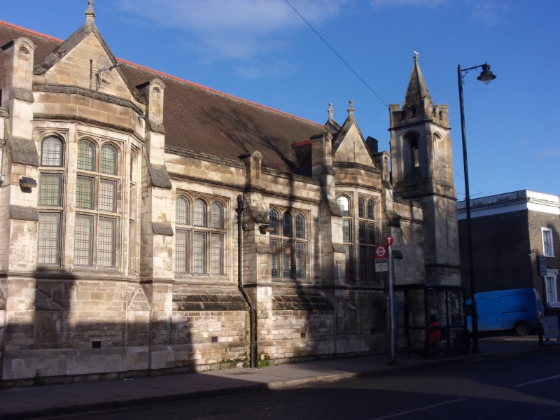
2. 1908 (Plaque in West bay). Stone faced building in collegiate Tudor style. Main East part of one storey, 6 bays divided by buttresses, with small angle tower and low spire. High pitched tiled roof and parapet. At left a narrow entrance link to one-bay dwelling section where roof comes down to eaves. Further 2-storey gabled left bay. Large stone mullioned and transomed windows, some canted bays. Back parts of brick in Art and Craft style.
Listing NGR: TQ3397793729
External links are from the relevant listing authority and, where applicable, Wikidata. Wikidata IDs may be related buildings as well as this specific building. If you want to add or update a link, you will need to do so by editing the Wikidata entry.


Other nearby listed buildings