Approximate Location Map
Large Map »
Latitude: 51.3673 / 51°22'2"N
Longitude: -0.0967 / 0°5'47"W
OS Eastings: 532594
OS Northings: 164856
OS Grid: TQ325648
Mapcode National: GBR GX.Q93
Mapcode Global: VHGRL.8WRQ
Plus Code: 9C3X9W83+W8
Entry Name: Gatepiers to Gates to Number 23
Listing Date: 15 February 1983
Grade: II
Source: Historic England
Source ID: 1079324
English Heritage Legacy ID: 201190
ID on this website: 101079324
Location: Croydon, London, CR0
County: London
District: Croydon
Electoral Ward/Division: Fairfield
Parish: Non Civil Parish
Built-Up Area: Croydon
Traditional County: Surrey
Lieutenancy Area (Ceremonial County): Greater London
Church of England Parish: Croydon St Andrew
Church of England Diocese: Southwark
Tagged with: Gatepost
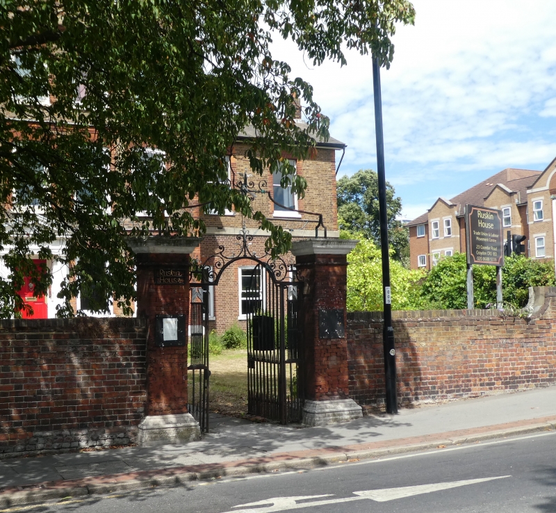
1.
5009
TQ 36 SW
5/6A
COOMBE ROAD
Gatepiers to gates to No 23
II
2.
Early C18. Red brick piers with stone plinth and caps. Wrought iron gate with sidepanels
and overthrow.
Listing NGR: TQ3259464856
External links are from the relevant listing authority and, where applicable, Wikidata. Wikidata IDs may be related buildings as well as this specific building. If you want to add or update a link, you will need to do so by editing the Wikidata entry.


Other nearby listed buildings
