Approximate Location Map
Large Map »
Latitude: 51.4989 / 51°29'56"N
Longitude: -0.2571 / 0°15'25"W
OS Eastings: 521074
OS Northings: 179212
OS Grid: TQ210792
Mapcode National: GBR 8S.CTP
Mapcode Global: VHGQX.HLD9
Plus Code: 9C3XFPXV+H4
Entry Name: 26 and 28, Queen Anne's Grove
Listing Date: 2 February 1970
Grade: II
Source: Historic England
Source ID: 1079374
English Heritage Legacy ID: 201027
ID on this website: 101079374
Location: Bedford Park, Ealing, London, W4
County: London
District: Ealing
Electoral Ward/Division: Southfield
Parish: Non Civil Parish
Built-Up Area: Ealing
Traditional County: Middlesex
Lieutenancy Area (Ceremonial County): Greater London
Church of England Parish: St Michael and All Angels Bedford Park
Church of England Diocese: London
Tagged with: Building
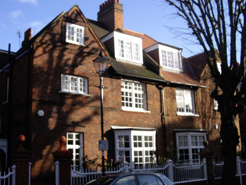
QUEEN ANNE'S GROVE
1.
5010
(east side)
Nos 26 and 28
TQ 2179 7/36 2.2.70
II GV
2.
Circa 1882. Probably by E J May. Red brick with tiled roofs. Two storeys
and attics, plain gable to each house. The glazing and porch to No 26 has
been altered. Gate piers to No 28.
Listing NGR: TQ2107479212
External links are from the relevant listing authority and, where applicable, Wikidata. Wikidata IDs may be related buildings as well as this specific building. If you want to add or update a link, you will need to do so by editing the Wikidata entry.


Other nearby listed buildings
