Latitude: 51.6531 / 51°39'11"N
Longitude: -0.0825 / 0°4'57"W
OS Eastings: 532745
OS Northings: 196662
OS Grid: TQ327966
Mapcode National: GBR H5.FVV
Mapcode Global: VHGQ7.JQ73
Plus Code: 9C3XMW38+6X
Entry Name: North East Building of Enfield Grammar School
Listing Date: 19 March 1951
Last Amended: 31 January 1974
Grade: II*
Source: Historic England
Source ID: 1079551
English Heritage Legacy ID: 200596
ID on this website: 101079551
Location: Enfield, London, EN2
County: London
District: Enfield
Electoral Ward/Division: Town
Parish: Non Civil Parish
Built-Up Area: Enfield
Traditional County: Middlesex
Lieutenancy Area (Ceremonial County): Greater London
Church of England Parish: St Andrew Enfield
Church of England Diocese: London
Tagged with: School building
1. 4411 CHURCH WALK (West Side) North-east building of Enfield Grammar School (Formerly listed as EnfieLd Grammar School) TQ 3296 7/109 19.3.51.
II* GV
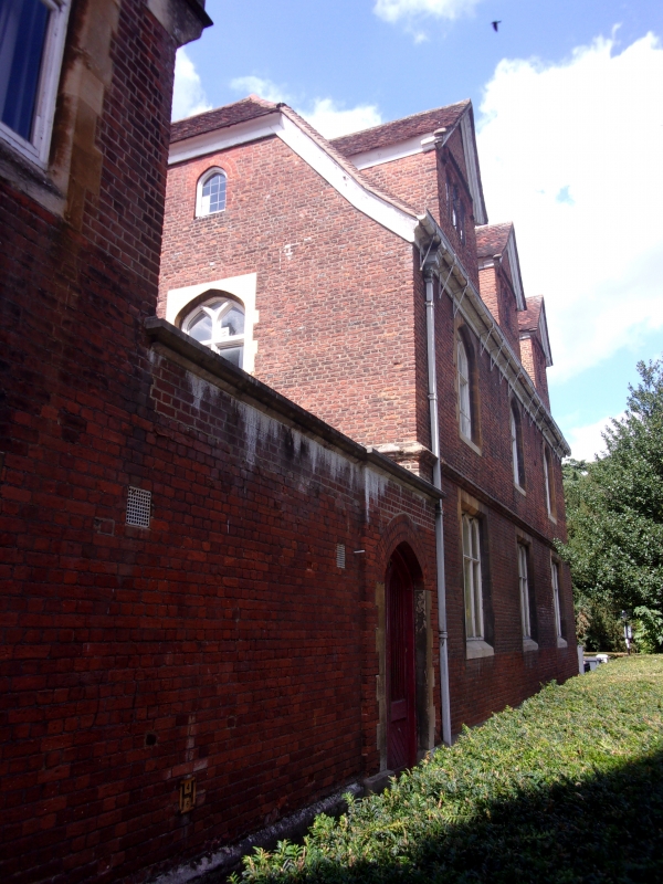
2. Late C16 red brick building of 2 storeys and attic, 3 windows. High pitched tiled roof with 3 gabled dormers. Moulded wood cornices to gables. Brick mullions and hoodmoulds to attic windows. Brick lst floor string. Lower part of ground floor now rendered. C19 wood mullioned windows in stone surrounds. Ground floor room covers whole area of the building, 50 feet by 21 feet 10 inches. Modern South extension.
North-east building of Enfield Grammar School, Uvedale House and Uvedale Cottage form a group.
Listing NGR: TQ3274596662
External links are from the relevant listing authority and, where applicable, Wikidata. Wikidata IDs may be related buildings as well as this specific building. If you want to add or update a link, you will need to do so by editing the Wikidata entry.


Other nearby listed buildings