Latitude: 51.5894 / 51°35'21"N
Longitude: 0.2478 / 0°14'52"E
OS Eastings: 555814
OS Northings: 190230
OS Grid: TQ558902
Mapcode National: GBR W1.F55
Mapcode Global: VHHN8.79WX
Plus Code: 9F32H6QX+Q4
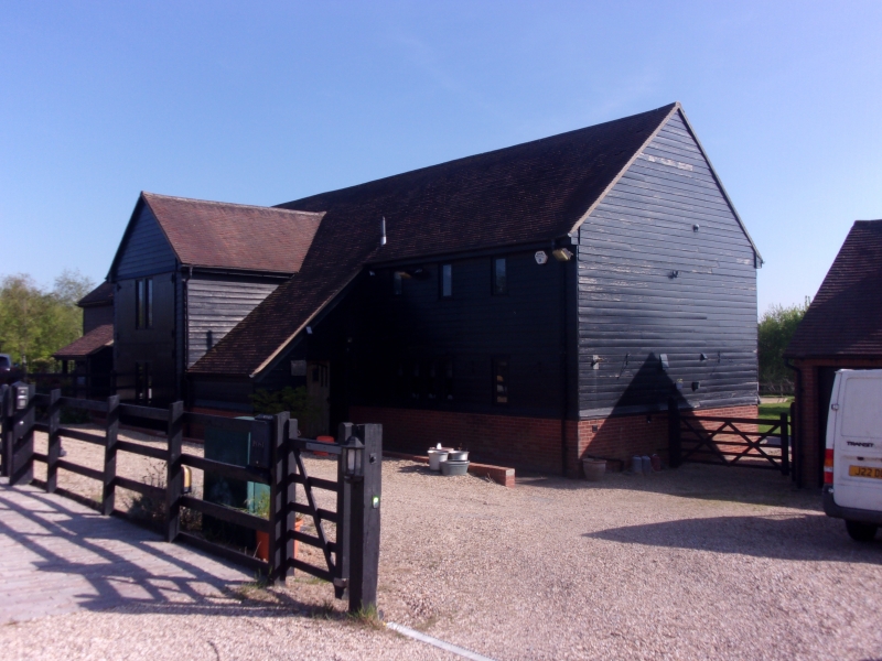
Entry Name: Range of barns and outbuildings forming a quadrangle at Page's Farmhouse
Listing Date: 9 August 1979
Grade: II
Source: Historic England
Source ID: 1079881
English Heritage Legacy ID: 201654
ID on this website: 101079881
Location: Havering, London, RM3
County: London
District: Havering
Electoral Ward/Division: Harold Wood
Parish: Non Civil Parish
Traditional County: Essex
Lieutenancy Area (Ceremonial County): Greater London
Church of England Parish: Harold Wood St Peter
Church of England Diocese: Chelmsford
Tagged with: Barn
This list entry was subject to a Minor Amendment on 8 May 2025 to correct a typo in the description and to reformat the text to current standards
TQ 59 SE
12/3A
Harold Wood
SHEPHERDS HILL
Range of barns and outbuildings forming a quadrangle at Page's Farmhouse
9.8.79.
GV
II
The barns and outbuildings include a late C19 timber-framed barn on a brick plinth with a wagon-entrance on the south side and tie-beam trusses of small scantling, supported on knees. Other outbuildings around the yard of late C19 date. To south of the yard a small three bay barn, late C18, timber-framed and weatherboarded with internal partitions. Collar and tie-beam trusses with clasped purlins and shallow arched braces.
Listing NGR: TQ5581490230
External links are from the relevant listing authority and, where applicable, Wikidata. Wikidata IDs may be related buildings as well as this specific building. If you want to add or update a link, you will need to do so by editing the Wikidata entry.


Other nearby listed buildings