Approximate Location Map
Large Map »
Latitude: 51.4963 / 51°29'46"N
Longitude: -0.1132 / 0°6'47"W
OS Eastings: 531076
OS Northings: 179174
OS Grid: TQ310791
Mapcode National: GBR LK.RS
Mapcode Global: VHGR0.0N18
Plus Code: 9C3XFVWP+GP
Entry Name: 136, Lambeth Road
Listing Date: 27 March 1981
Grade: II
Source: Historic England
Source ID: 1080375
English Heritage Legacy ID: 204406
ID on this website: 101080375
Location: Lambeth, London, SE1
County: London
District: Lambeth
Electoral Ward/Division: Bishop's
Parish: Non Civil Parish
Built-Up Area: Lambeth
Traditional County: Surrey
Lieutenancy Area (Ceremonial County): Greater London
Church of England Parish: North Lambeth
Church of England Diocese: Southwark
Tagged with: Building
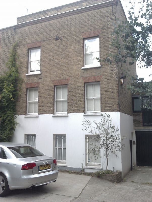
LAMBETH ROAD SE1
1. (north side)
5023
No 136
TQ 3179 3/593
II GV
2.
Circa 1800. Three storeys, three windows. Stock brick with later parapet. No
centre window on top floor. Gauged flat brick arches to replaced sash windows.
Plain modern door on return. Included for group value.
Listing NGR: TQ3107679174
External links are from the relevant listing authority and, where applicable, Wikidata. Wikidata IDs may be related buildings as well as this specific building. If you want to add or update a link, you will need to do so by editing the Wikidata entry.


Other nearby listed buildings
