Latitude: 51.4857 / 51°29'8"N
Longitude: -0.1088 / 0°6'31"W
OS Eastings: 531410
OS Northings: 178002
OS Grid: TQ314780
Mapcode National: GBR MP.QL
Mapcode Global: VHGR0.2XBF
Plus Code: 9C3XFVPR+7F
Entry Name: Forecourt Wall and Piers to Number 180
Listing Date: 27 March 1981
Grade: II
Source: Historic England
Source ID: 1080392
English Heritage Legacy ID: 204345
ID on this website: 101080392
Location: Kennington, Lambeth, London, SE11
County: London
District: Lambeth
Electoral Ward/Division: Prince's
Parish: Non Civil Parish
Built-Up Area: Lambeth
Traditional County: Surrey
Lieutenancy Area (Ceremonial County): Greater London
Church of England Parish: North Lambeth
Church of England Diocese: Southwark
Tagged with: Wall
KENNINGTON PARK ROAD SE11 1. (west side) 5023 Forecourt wall and piers to No 180 TQ 3178 5/523 TQ 3177 8/523
II GV
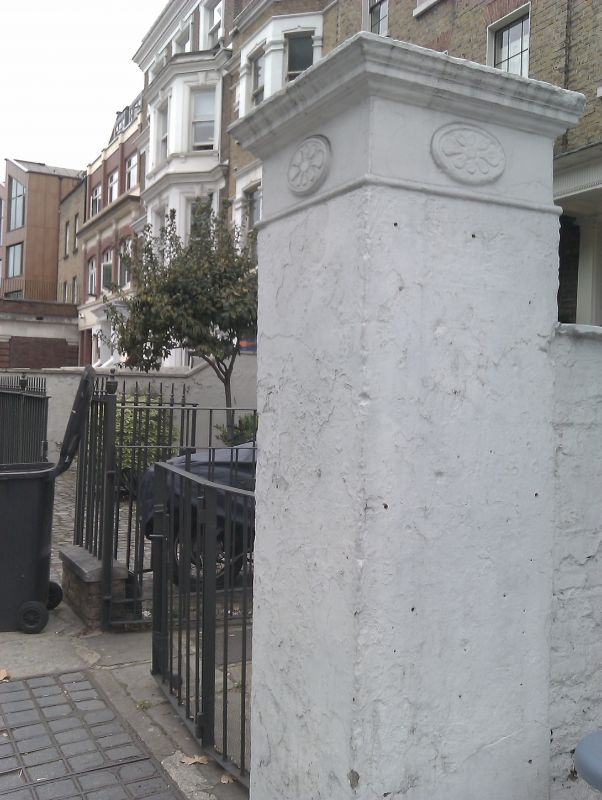
2. Early C19. Low stone-coped stuccoed wall; at each end a tall stuccoed pier with stone top and ornamental oval panel in frieze.
Listing NGR: TQ3141078002
External links are from the relevant listing authority and, where applicable, Wikidata. Wikidata IDs may be related buildings as well as this specific building. If you want to add or update a link, you will need to do so by editing the Wikidata entry.


Other nearby listed buildings