Latitude: 51.4664 / 51°27'58"N
Longitude: -0.1198 / 0°7'11"W
OS Eastings: 530703
OS Northings: 175831
OS Grid: TQ307758
Mapcode National: GBR KX.8J
Mapcode Global: VHGR5.WD1Q
Plus Code: 9C3XFV8J+G3
Entry Name: The Marquess of Lorne Public House
Listing Date: 27 March 1981
Grade: II
Source: Historic England
Source ID: 1080455
English Heritage Legacy ID: 204207
ID on this website: 101080455
Location: Union Mews, Lambeth, London, SW9
County: London
District: Lambeth
Electoral Ward/Division: Ferndale
Parish: Non Civil Parish
Built-Up Area: Lambeth
Traditional County: Surrey
Lieutenancy Area (Ceremonial County): Greater London
Church of England Parish: Stockwell, St Andrew and St Michael
Church of England Diocese: Southwark
Tagged with: Pub
DALYELL ROAD SW9 1. (east side) 5023 The Marquess of Lorne Public House TQ 3075 17/340
II
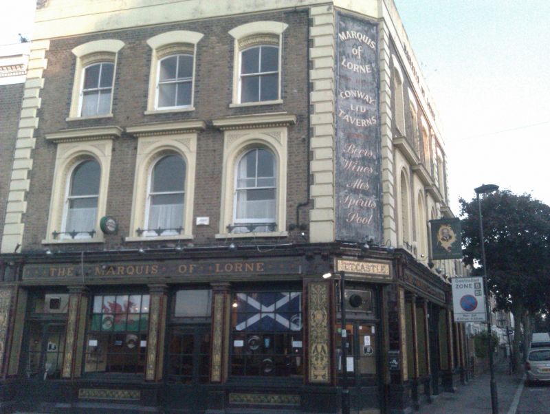
2. Mid C19 3-storey, 4-window building with canted corner to 3-window front on Combermere Road. Stock brick. Stucco rusticated quoins and entablature (missing cornice). Segmental second-floor and round-arched first floor windows in deep reveal surrounds of terra-cotta with leafy and geometrical patterns; dentil cornices over first floor windows. Ground floor wall panels, pilasters and entablature (including lettering of fascia) in green, gold and brown glazed tiles. Arabesque pattern on pilasters, paterae in capitals and leafy patterns in relief tiles on stallrisers. An interesting example of architectural use of glazed tiles.
Listing NGR: TQ3070375831
External links are from the relevant listing authority and, where applicable, Wikidata. Wikidata IDs may be related buildings as well as this specific building. If you want to add or update a link, you will need to do so by editing the Wikidata entry.


Other nearby listed buildings