Latitude: 51.4612 / 51°27'40"N
Longitude: -0.1183 / 0°7'5"W
OS Eastings: 530818
OS Northings: 175254
OS Grid: TQ308752
Mapcode National: GBR KZ.LD
Mapcode Global: VHGR5.WJTR
Plus Code: 9C3XFV6J+FM
Entry Name: Trinity Homes with Former Wash House Block and Linking Walls
Listing Date: 27 March 1981
Grade: II
Source: Historic England
Source ID: 1080559
English Heritage Legacy ID: 203969
ID on this website: 101080559
Location: Brixton, Lambeth, London, SW2
County: London
District: Lambeth
Electoral Ward/Division: Ferndale
Parish: Non Civil Parish
Built-Up Area: Lambeth
Traditional County: Surrey
Lieutenancy Area (Ceremonial County): Greater London
Church of England Parish: Brixton St Matthew with St Jude
Church of England Diocese: Southwark
Tagged with: Almshouse
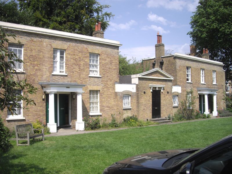
ACRE LANE SW2 1. (north side) 5023 Nos 13 to 16 (consec) Trinity Homes with former wash-house block and linking walls TQ 3075 17/3
II GV
2. 1822. Two blocks, each of 2 storeys, 3 windows, with linking walls to small central building originally the wash-house. Stock brick with stone cornice and blocking course. Gauged flat brick arches to sash windows with glazing bars; and paired doors under wood prostyle Doric porch. Central block of one storey, one bay, blank in front with stone cornice and pediment; and central door under console bracketed cornice. Door openings in links.
Listing NGR: TQ3081875253
External links are from the relevant listing authority and, where applicable, Wikidata. Wikidata IDs may be related buildings as well as this specific building. If you want to add or update a link, you will need to do so by editing the Wikidata entry.


Other nearby listed buildings