Approximate Location Map
Large Map »
Latitude: 51.4998 / 51°29'59"N
Longitude: -0.1845 / 0°11'4"W
OS Eastings: 526113
OS Northings: 179438
OS Grid: TQ261794
Mapcode National: GBR 2J.RJ
Mapcode Global: VHGQY.RK9L
Plus Code: 9C3XFRX8+W5
Entry Name: De Vere Mews
Listing Date: 7 July 1972
Grade: II
Source: Historic England
Source ID: 1080704
English Heritage Legacy ID: 203611
ID on this website: 101080704
Location: Kensington, Kensington and Chelsea, London, W8
County: London
District: Kensington and Chelsea
Electoral Ward/Division: Queen's Gate
Parish: Non Civil Parish
Built-Up Area: Kensington and Chelsea
Traditional County: Middlesex
Lieutenancy Area (Ceremonial County): Greater London
Church of England Parish: St Mary Abbots with Christ Church and St Philip Kensington
Church of England Diocese: London
Tagged with: Building
This list entry was subject to a Minor Amendment on 25/03/2015
TQ 2679 SW
38/1
De Vere Mews
1-18 (consec) De Vere Mews
39, 39a, 41-51 (odd) De Vere Gardens
No 20. Canning Place
(Formerly listed as De Vere Mews Nos 1 to 15 (consec) CANNING PLACE W8)
7.7.72
GV
II
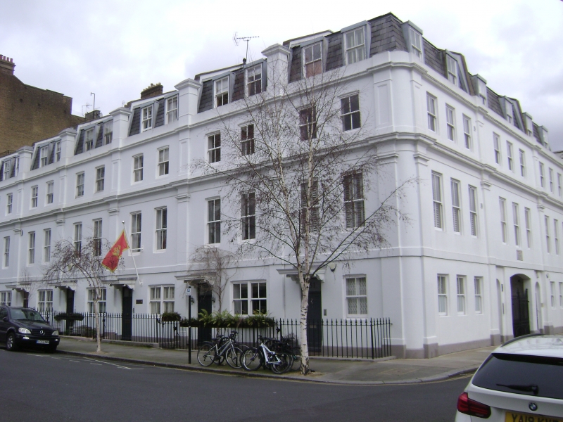
Former Mews converted to dwellings. Probably mid C19. Three storeys. Stucco. Slated mansard with C20 dormers. Nine windows altogether to Canning Place; pilasters; segmental arched entrance to centre. Internal galleried courtyard with segmental barrel vaults to galleries. Segmental brick entrances below, now blocked.
External links are from the relevant listing authority and, where applicable, Wikidata. Wikidata IDs may be related buildings as well as this specific building. If you want to add or update a link, you will need to do so by editing the Wikidata entry.


Other nearby listed buildings
