Approximate Location Map
Large Map »
Latitude: 51.4467 / 51°26'48"N
Longitude: -0.3257 / 0°19'32"W
OS Eastings: 516446
OS Northings: 173298
OS Grid: TQ164732
Mapcode National: GBR 76.LJJ
Mapcode Global: VHGR2.9WNT
Plus Code: 9C3XCMWF+MP
Entry Name: 23, the Embankment
Listing Date: 2 September 1952
Grade: II
Source: Historic England
Source ID: 1080816
English Heritage Legacy ID: 205305
ID on this website: 101080816
Location: Twickenham, Richmond upon Thames, London, TW1
County: London
District: Richmond upon Thames
Electoral Ward/Division: Twickenham Riverside
Parish: Non Civil Parish
Built-Up Area: Richmond upon Thames
Traditional County: Middlesex
Lieutenancy Area (Ceremonial County): Greater London
Church of England Parish: St Mary the Virgin Twickenham
Church of England Diocese: London
Tagged with: Building
1.
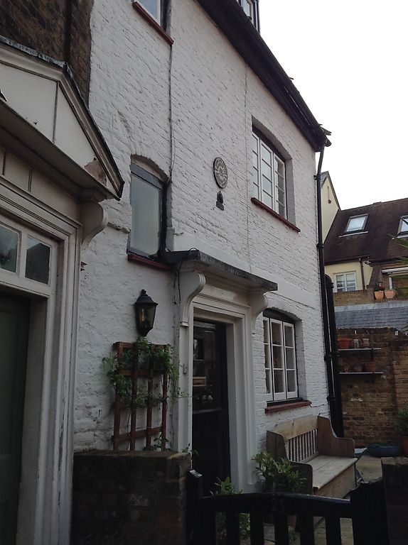
5028 THE EMBANKMENT
No 23
TQ 1673 21/44 2.9.52
II
2.
C18 house of 2-storeys and attic. One window wide plus entrance door with restored
doorcase. Casement windows. Tiled roof with dormer.
Listing NGR: TQ1644673298
External links are from the relevant listing authority and, where applicable, Wikidata. Wikidata IDs may be related buildings as well as this specific building. If you want to add or update a link, you will need to do so by editing the Wikidata entry.


Other nearby listed buildings
