Latitude: 52.1381 / 52°8'17"N
Longitude: -1.9203 / 1°55'13"W
OS Eastings: 405550
OS Northings: 248870
OS Grid: SP055488
Mapcode National: GBR 3KS.TKL
Mapcode Global: VHB0M.NJN8
Plus Code: 9C4W43QH+6V
Entry Name: Dalkeith
Listing Date: 9 January 1987
Grade: II
Source: Historic England
Source ID: 1081588
English Heritage Legacy ID: 148688
ID on this website: 101081588
Location: Harvington, Wychavon, Worcestershire, WR11
County: Worcestershire
District: Wychavon
Civil Parish: Harvington
Built-Up Area: Harvington
Traditional County: Worcestershire
Lieutenancy Area (Ceremonial County): Worcestershire
Church of England Parish: Harvington
Church of England Diocese: Worcester
Tagged with: Building
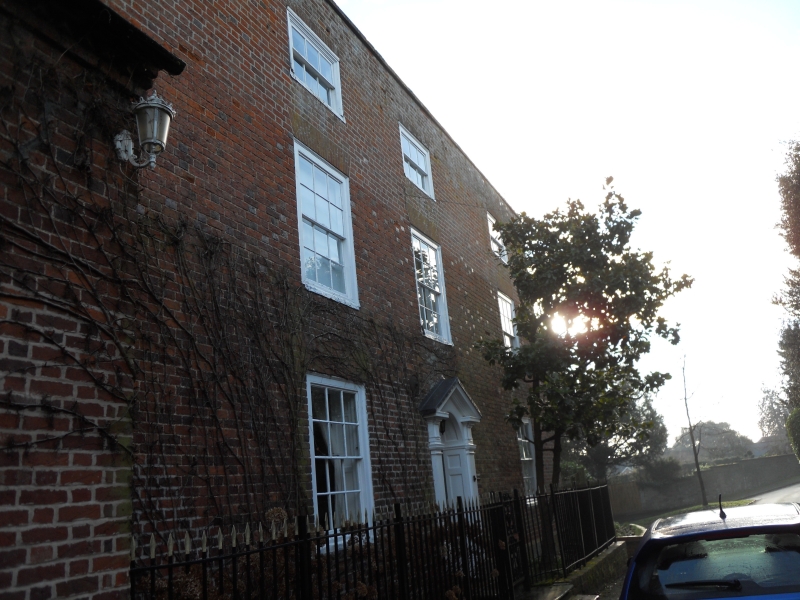
HARVINGTON CP VILLAGE STREET (east side)
SP 0448 - SP 0548
10/85 Dalkeith
- II
House. Late C18 with some mid-C20 alterations. Brick with tile roof,
gable-end stack. Three storeys, tall stone coped parapet; three windows,
boxed glazing bar sashes. The second floor has 6-pane boxed sashes. Central
entrance with pilastered wooden doorcase with open pediment and fanlight.
Listing NGR: SP0555048870
External links are from the relevant listing authority and, where applicable, Wikidata. Wikidata IDs may be related buildings as well as this specific building. If you want to add or update a link, you will need to do so by editing the Wikidata entry.


Other nearby listed buildings