Latitude: 52.2869 / 52°17'12"N
Longitude: -2.7687 / 2°46'7"W
OS Eastings: 347659
OS Northings: 265696
OS Grid: SO476656
Mapcode National: GBR BH.Y51C
Mapcode Global: VH770.YSN7
Plus Code: 9C4V76PJ+QG
Entry Name: Gate House Farmhouse
Listing Date: 11 June 1959
Grade: II
Source: Historic England
Source ID: 1081787
English Heritage Legacy ID: 150157
ID on this website: 101081787
Location: Bircher, County of Herefordshire, HR6
County: County of Herefordshire
Civil Parish: Croft and Yarpole
Traditional County: Herefordshire
Lieutenancy Area (Ceremonial County): Herefordshire
Church of England Parish: Croft with Yarpole and Lucton
Church of England Diocese: Hereford
Tagged with: Farmhouse
YARPOLE CP BIRCHER SO 46 NE 3/134 Gate House Farmhouse 11.6.59 GV II
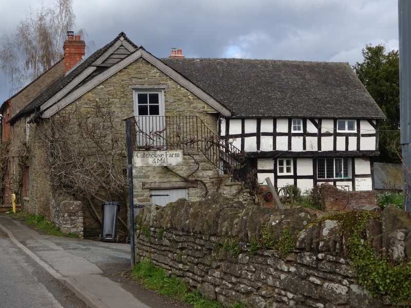
Farmhouse. C16, extended C17, partly rebuilt mid-C18 and mid-C19 with some late C20 restoration. Timber-frame with rendered infill rebuilt in coursed rubble and brick, all under a tile roof. L-plan, C16 range to east with lateral stack to north wall. C17 range to south with central axial stack. West front of two storeys, rebuilt in C19 brick to left with two 4-pane sashes under plastered wedge lintels. Ground floor has a 6-pane sash to left and an entrance to right with four-panel door, overlight and wedge lintel. To right rebuilt in C18 rubble, with a 2- and a 3-light casement to each floor. Framing of C16 range visible from south, jettied first floor with chamfered bressummer on carved brackets rising from pilasters. Walls are four square panels high with straight angle braces. Upper floor of C17 range has framing two square panels high. Interior: has heavily moulded ceiling beams with chamfered and stopped subsidiaries. (RCHM, 3, pp 216-7; no 26).
Listing NGR: SO4765965696
External links are from the relevant listing authority and, where applicable, Wikidata. Wikidata IDs may be related buildings as well as this specific building. If you want to add or update a link, you will need to do so by editing the Wikidata entry.


Other nearby listed buildings