Latitude: 52.1053 / 52°6'19"N
Longitude: -2.8401 / 2°50'24"W
OS Eastings: 342554
OS Northings: 245550
OS Grid: SO425455
Mapcode National: GBR FF.9D40
Mapcode Global: VH77Y.QBDY
Plus Code: 9C4V4545+4W
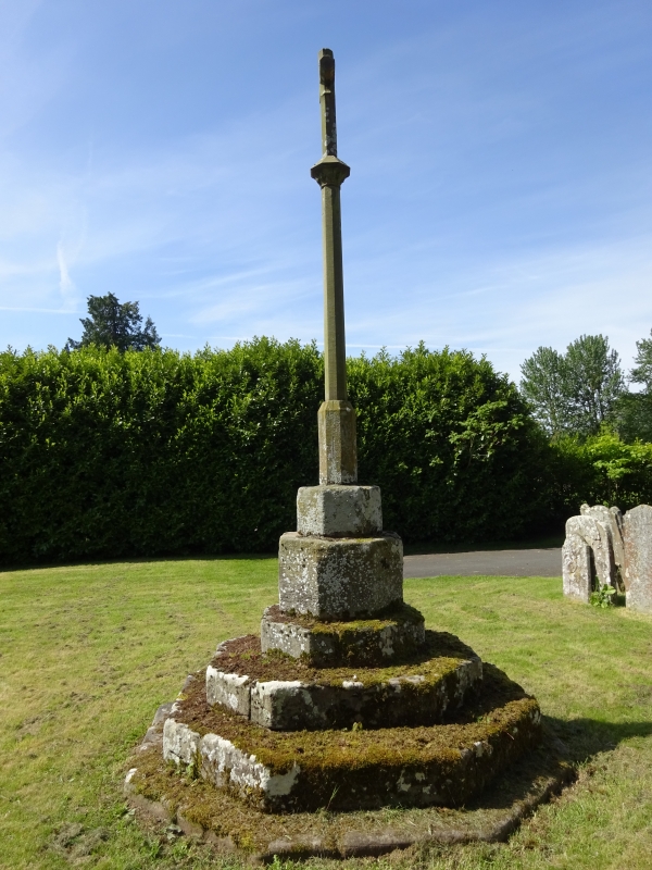
Entry Name: Churchyard Cross About 15 Yards South-West of the South-East Corner of the South Porch of the Church of St Michael
Listing Date: 2 September 1966
Grade: II
Source: Historic England
Source ID: 1081952
English Heritage Legacy ID: 149737
ID on this website: 101081952
Location: St Michael's Church, Mansel Lacy, County of Herefordshire, HR4
County: County of Herefordshire
Civil Parish: Mansell Lacy
Traditional County: Herefordshire
Lieutenancy Area (Ceremonial County): Herefordshire
Church of England Parish: Mansel Lacy with Yazor
Church of England Diocese: Hereford
MANSELL LACY CP - SO 44 NW
4/56 Churchyard cross about 15 yards south-west of 2.9.66 the south-east corner of the south porch of the Church of St Michael GV II
Churchyard cross. Probably C14 with later alterations. Finely cut sandstone. Octagonal. Three steps to base which has trefoil-headed niche in west side. Smaller octagonal base above the main one supports early C20 shaft and cross. (RCHM, Vol III, p 146).
Listing NGR: SO4255445550


Other nearby listed buildings