Latitude: 53.8129 / 53°48'46"N
Longitude: -0.1965 / 0°11'47"W
OS Eastings: 518841
OS Northings: 436687
OS Grid: TA188366
Mapcode National: GBR WS2B.7X
Mapcode Global: WHHGK.YFL9
Plus Code: 9C5XRR73+59
Entry Name: The Orangery Approximately 10 Metres to South-West of Burton Constable Hall
Listing Date: 16 December 1966
Grade: II*
Source: Historic England
Source ID: 1083445
English Heritage Legacy ID: 166679
ID on this website: 101083445
Location: Burton Constable, East Riding of Yorkshire, HU11
County: East Riding of Yorkshire
Civil Parish: Burton Constable
Traditional County: Yorkshire
Lieutenancy Area (Ceremonial County): East Riding of Yorkshire
Church of England Parish: Swine with Ellerby St Mary
Church of England Diocese: York
Tagged with: Orangery
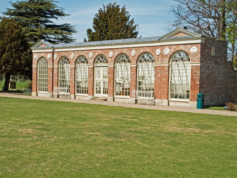
BURTON CONSTABLE BURTON CONSTABLE PARK TA 1836-1936 9/4 The Orangery approximately 10 metres 16.12.66 to south-west of Burton Constable Hall GV II * Orangery. 1788-89 with later additions and alterations. By Thomas Atkinson for William Constable. Pinkish-red brick in Flemish bond with ashlar dressings and glass roof. Single storey, 7 bays, with outshut to rear, the outer bays break forward slightly and are pedimented. Ashlar plinth. 3 steps to central entrance, double multi-paned glass doors with fanlight with glazing bars. Otherwise 30-pane round-arched sashes with radial glazing to heads to full height. Moulded impost band. Paterae in spandrels, except to outer bays which have circular plaques with figures. Frieze decorated with palm fronds, cornice and low parapet surmounted by central figure of plenty flanked by urns, pineapple finials and female figures to outer pediments. Roof slopes downwards to rear.
Listing NGR: TA1884136687
External links are from the relevant listing authority and, where applicable, Wikidata. Wikidata IDs may be related buildings as well as this specific building. If you want to add or update a link, you will need to do so by editing the Wikidata entry.


Other nearby listed buildings