Latitude: 53.9171 / 53°55'1"N
Longitude: -0.8053 / 0°48'19"W
OS Eastings: 478566
OS Northings: 447429
OS Grid: SE785474
Mapcode National: GBR QRT4.GL
Mapcode Global: WHFCF.LSRZ
Plus Code: 9C5XW58V+RV
Entry Name: Church of Saint Botolph
Listing Date: 14 April 1987
Grade: II
Source: Historic England
Source ID: 1083874
English Heritage Legacy ID: 167623
Also known as: Saint Botolph Church, Allerthorpe
ID on this website: 101083874
Location: St Botolph's Church, Allerthorpe, East Riding of Yorkshire, YO42
County: East Riding of Yorkshire
Civil Parish: Allerthorpe
Traditional County: Yorkshire
Lieutenancy Area (Ceremonial County): East Riding of Yorkshire
Church of England Parish: Allerthorpe St Botolph
Church of England Diocese: York
Tagged with: Church building
ALLERTHORPE MAIN STREET SE 74 NE (south side)
5/2 Church of Saint Botolph
- II
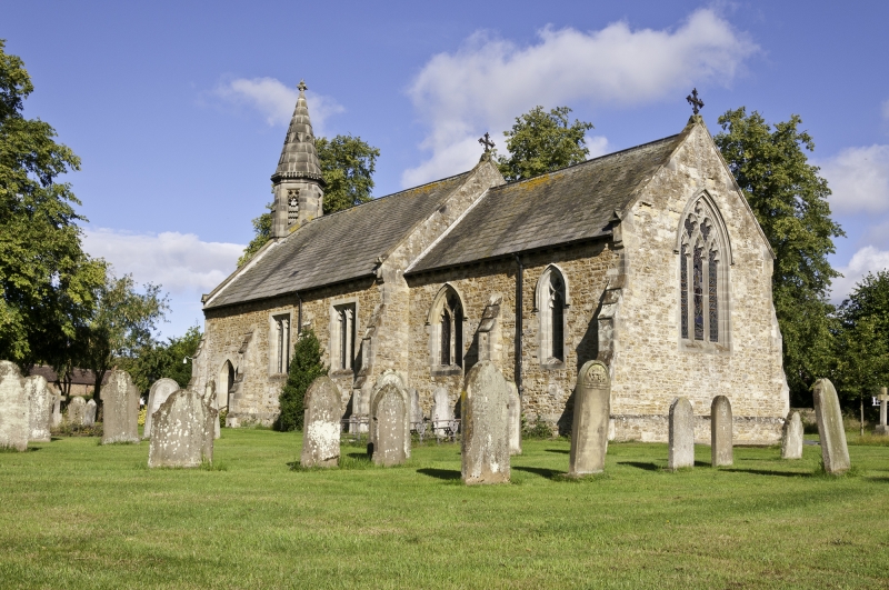
Church. 1876, by J B and W Atkinson, in Gothic revival style. Rubble with freestone dressings, graduated slate roof. West bell-turret, 3-bay nave and 2-bay chancel. Nave: buttresses with offsets. Pointed door with continuous mouldings to left. 2 square-headed 2-light windows with tracery in Perpendicular style. Raised coped gables, cross finial. Octagonal bell turret corbelled out over mid-wall buttress to west elevation. Square- headed cusped belfry openings to cardinal faces brattished cornice, and short spire with lucarnes. Poppy-head finial. Chancel: plinth, buttresses with offsets. 2-light pointed window with curvilinear tracery under hood- mould to left, lancet under hood-mould to right. 3-light pointed east window with curvilinear tracery under hood-mould. Raised coped gables, cross finial.
Listing NGR: SE7856647429
External links are from the relevant listing authority and, where applicable, Wikidata. Wikidata IDs may be related buildings as well as this specific building. If you want to add or update a link, you will need to do so by editing the Wikidata entry.


Other nearby listed buildings