Approximate Location Map
Large Map »
Latitude: 53.8441 / 53°50'38"N
Longitude: -0.4343 / 0°26'3"W
OS Eastings: 503108
OS Northings: 439790
OS Grid: TA031397
Mapcode National: GBR TRDZ.RQ
Mapcode Global: WHGF4.9MFW
Plus Code: 9C5XRHV8+M7
Entry Name: Perimeter Wall, Gatepiers and Gates to the Church of St Mary
Listing Date: 30 June 1987
Grade: II
Source: Historic England
Source ID: 1084011
English Heritage Legacy ID: 167347
ID on this website: 101084011
Location: Beverley, East Riding of Yorkshire, HU17
County: East Riding of Yorkshire
Civil Parish: Beverley
Built-Up Area: Beverley
Traditional County: Yorkshire
Lieutenancy Area (Ceremonial County): East Riding of Yorkshire
Church of England Parish: Beverley St Mary
Church of England Diocese: York
Tagged with: Wall
TA 0339 BEVERLEY NORTH BAR WITHIN
(east side)
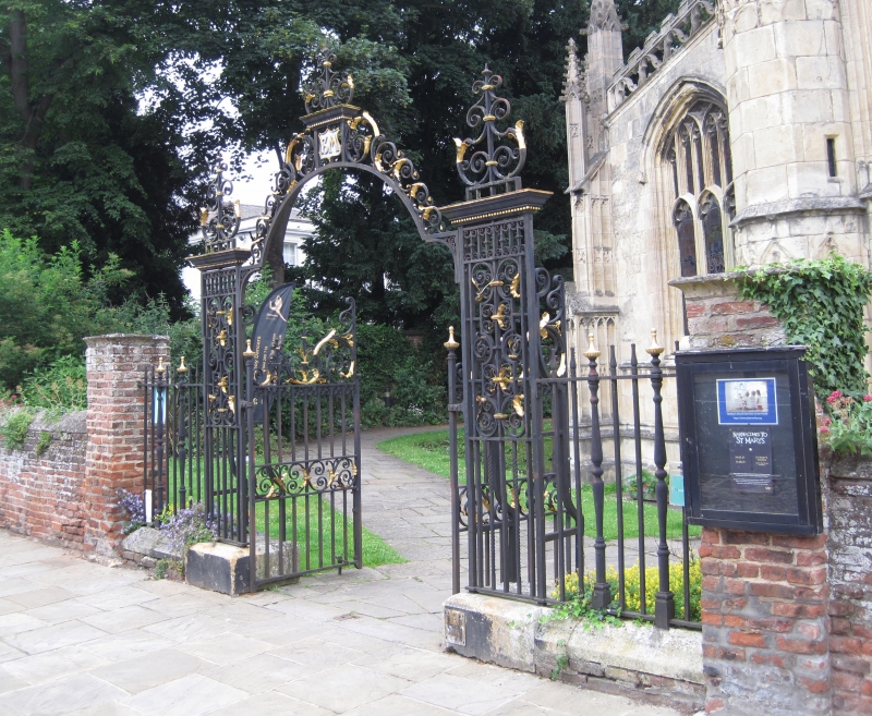
9/229 Perimeter wall, gatepiers
and gates to the Church
of St Mary
GV II
Probably C18. Stone-coped brick wall about 5 ft high with brick gatepiers with
wrought iron gates and overthrow of 1889, but in C18 style.
Listing NGR: TA0312439816
External links are from the relevant listing authority and, where applicable, Wikidata. Wikidata IDs may be related buildings as well as this specific building. If you want to add or update a link, you will need to do so by editing the Wikidata entry.


Other nearby listed buildings
