Approximate Location Map
Large Map »
Latitude: 53.842 / 53°50'31"N
Longitude: -0.4328 / 0°25'58"W
OS Eastings: 503214
OS Northings: 439550
OS Grid: TA032395
Mapcode National: GBR TSF0.3H
Mapcode Global: WHGF4.BP4K
Plus Code: 9C5XRHR8+QV
Entry Name: 34, Lairgate
Listing Date: 30 June 1987
Grade: II
Source: Historic England
Source ID: 1084014
English Heritage Legacy ID: 167256
ID on this website: 101084014
Location: Beverley, East Riding of Yorkshire, HU17
County: East Riding of Yorkshire
Civil Parish: Beverley
Built-Up Area: Beverley
Traditional County: Yorkshire
Lieutenancy Area (Ceremonial County): East Riding of Yorkshire
Church of England Parish: Beverley St Mary
Church of England Diocese: York
Tagged with: Building
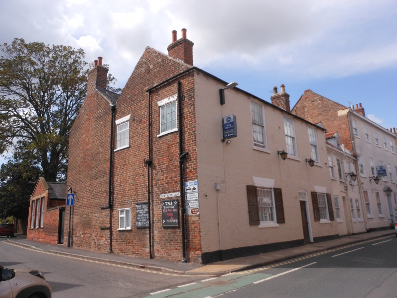
TA 0339 BEVERLEY LAIRGATE
(west side)
9/155 No 34
GV II
C18. Two storeys in painted brick. Double span slate roof. Three windows,
hung sashes with glazing bars, over 2 with rendered lintels. Segmental-headed
doorway with 6-panel door and 3-pane fanlight.
Listing NGR: TA0321439550
External links are from the relevant listing authority and, where applicable, Wikidata. Wikidata IDs may be related buildings as well as this specific building. If you want to add or update a link, you will need to do so by editing the Wikidata entry.


Other nearby listed buildings
