Approximate Location Map
Large Map »
Latitude: 53.8382 / 53°50'17"N
Longitude: -0.4264 / 0°25'34"W
OS Eastings: 503646
OS Northings: 439145
OS Grid: TA036391
Mapcode National: GBR TSG1.HV
Mapcode Global: WHGF4.FS6F
Plus Code: 9C5XRHQF+7F
Entry Name: 12, Keldgate
Listing Date: 30 June 1987
Grade: II
Source: Historic England
Source ID: 1084043
English Heritage Legacy ID: 167217
ID on this website: 101084043
Location: Beverley, East Riding of Yorkshire, HU17
County: East Riding of Yorkshire
Civil Parish: Beverley
Built-Up Area: Beverley
Traditional County: Yorkshire
Lieutenancy Area (Ceremonial County): East Riding of Yorkshire
Church of England Parish: Beverley Minster St John and St Martin
Church of England Diocese: York
Tagged with: Building
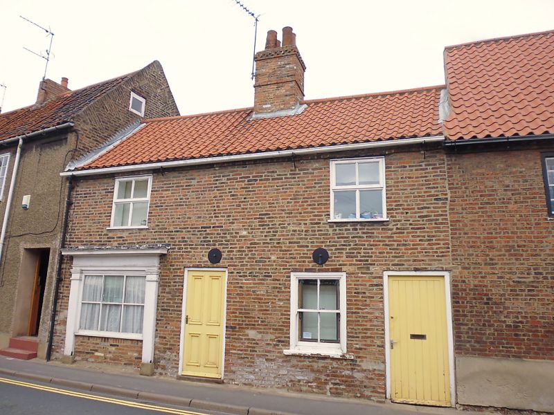
TA 0339 BEVERLEY KELDGATE
(north side)
10/117 No 12
GV II
Late C18. 2 storeys in brick with pantile roof. 2 casement windows, no glazing
bars. Ground floor has shop window with glazing bars and plain pilasters and
1 window and passage door and plain door. Included as part of a group.
Listing NGR: TA0364639145
External links are from the relevant listing authority and, where applicable, Wikidata. Wikidata IDs may be related buildings as well as this specific building. If you want to add or update a link, you will need to do so by editing the Wikidata entry.


Other nearby listed buildings
