Latitude: 53.9881 / 53°59'17"N
Longitude: -0.6559 / 0°39'21"W
OS Eastings: 488230
OS Northings: 455510
OS Grid: SE882555
Mapcode National: GBR RQVB.T3
Mapcode Global: WHGDF.W0VZ
Plus Code: 9C5XX8QV+6M
Entry Name: Church of St. Mary
Listing Date: 26 January 1967
Grade: I
Source: Historic England
Source ID: 1084147
English Heritage Legacy ID: 166972
Also known as: St Mary's Church, Huggate
ID on this website: 101084147
Location: St Mary's Church, Huggate, East Riding of Yorkshire, YO42
County: East Riding of Yorkshire
Civil Parish: Huggate
Built-Up Area: Huggate
Traditional County: Yorkshire
Lieutenancy Area (Ceremonial County): East Riding of Yorkshire
Church of England Parish: Huggate St Mary
Church of England Diocese: York
Tagged with: Church building
SE 85 NE HUGGATE CHURCH STREET (east side)
2/4 Church of St. Mary (Formerly listed under General) 26.1.67 I
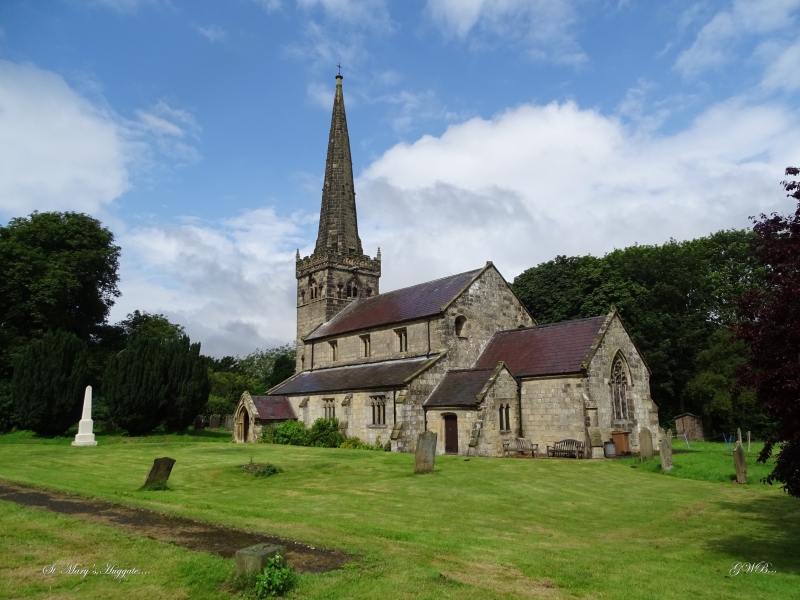
Church. C12 nave and aisles, C13 chancel, early C14 west tower with recessed spire, C19 south porch and south vestry. Ashlar with slate roofs. West tower, 4-bay nave, l-bay chancel. West tower: dwarf diagonal buttresses, 2 trefoil-headed lights under pointed arch to each belfry opening. Cusped running scroll under blank quatrefoil panels to crenellated parapet. Crocketed corner pinnacles. Spire has shallow buttresses with offsets to diagonal sides, 3 tiers of crocketing, and finial cross. Nave: two 3-light square-headed windows with ogee tracery to south aisle, 3 C15 square-headed windows with cusped tracery to clerestory. Raised coped gable. In the east gable at the level of the clerestory are 2 small rounded-headed windows, with shafts; they have been extensively restored, but may have been retained from an earlier phase. Chancel: pointed 3-light east window, with C19 tracery: Geometrical style, under hoodmould. Interior: pointed tower arch of 2 chamfered arches dying into the responds. Late C12 north arcade with pointed arches of 2 square orders on polygonal abaci and round piers. South arcade of c1190 with double-chamfered pointed arches on polygonal abaci with leaf ornament and heads in high relief. Round piers, keel-moulded responds. Blocked door to former rood loft: pointed with continuous chamfer. C12 chancel arch of 3 square orders to nave with attached columns supporting scallop capitals, one with a volute. C15 octagonal font with bases to colonnettes, now removed, to diagonal sides, set on square plinth with cusped, pierced panels. Charity board dated 1826 to nave west wall. At least 2 earlier rooflines discernible over tower arch.
Listing NGR: SE8822855510
External links are from the relevant listing authority and, where applicable, Wikidata. Wikidata IDs may be related buildings as well as this specific building. If you want to add or update a link, you will need to do so by editing the Wikidata entry.


Other nearby listed buildings