Latitude: 53.9336 / 53°56'1"N
Longitude: -0.5596 / 0°33'34"W
OS Eastings: 494667
OS Northings: 449571
OS Grid: SE946495
Mapcode National: GBR SQJY.NN
Mapcode Global: WHGDP.CDS8
Plus Code: 9C5XWCMR+C5
Entry Name: Church of St. Andrew
Listing Date: 20 September 1966
Grade: II*
Source: Historic England
Source ID: 1084151
English Heritage Legacy ID: 166977
Also known as: St Andrew's Church, Middleton-on-the-Wolds
ID on this website: 101084151
Location: St Andrew's Church, Middleton-on-the-Wolds, East Riding of Yorkshire, YO25
County: East Riding of Yorkshire
Civil Parish: Middleton
Built-Up Area: Middleton-on-the-Wolds
Traditional County: Yorkshire
Lieutenancy Area (Ceremonial County): East Riding of Yorkshire
Church of England Parish: Middleton-on-Wolds St Andrew
Church of England Diocese: York
Tagged with: Church building
SE 94 NW MIDDLETON FRONT STREET (south side)
12/9 Church of St. Andrew
20.9.66 II*
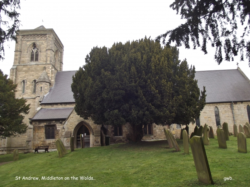
Church. Early C13 chancel and nave arcades; otherwise rebuilt 1873 by S.M. Teale, who incorporated old masonry. Ashlar with slate roofs. West tower, 4-bay aisled nave with south porch, 4-bay chancel. West tower: 3 stages with angle buttresses to lower stages and pilaster buttresses with nook shafts to belfry. Chamfered plinth and string courses. Double trefoil-headed lancets under hoodmoulds to second stage, 2-light pointed opening, with tracery in Geometrical style, under hoodmould, to belfry. Frieze of blank quatrefoils beneath corbel-table to coped parapet: pyramidal roof with cross finial. Pointed 3-light window with tracery in Geometrical style under stopped hoodmould. Nave:chamfered plinth, buttresses with offsets. Three 2-light square-headed windows with tracery in Perpendicular style. South door in style of cll8O with re-used nook shafts and C19 waterleaf capitals supporting pointed roll-moulded arch under hoodmould with face-stops. Chancel: chamfered plinth, angle buttresses with two offsets. Four lancets to each side. Dwarf buttresses to east wall: east window of 3 stepped lancets under a single pointed arch of which the imposts extend to north and south as a chamfered string. Interior: C13 north and south arcades of round piers, (one octagonal pier to south arcade), supporting round capitals under pointed double-chamfered arches. Chancel: 3 sedilia with pointed chamfered heads on detached shafts with round capitals and bases. Bronze Age beaker, discovered locally, preserved in special niche in north respond of chancel arch. C12 tub font: stylised palm design and intersecting round arcading to tub which rests on attached colonettes with nail-head to capitals.
Listing NGR: SE9466749571
External links are from the relevant listing authority and, where applicable, Wikidata. Wikidata IDs may be related buildings as well as this specific building. If you want to add or update a link, you will need to do so by editing the Wikidata entry.


Other nearby listed buildings