Approximate Location Map
Large Map »
Latitude: 51.1291 / 51°7'44"N
Longitude: 0.2626 / 0°15'45"E
OS Eastings: 558415
OS Northings: 139086
OS Grid: TQ584390
Mapcode National: GBR MPZ.17C
Mapcode Global: VHHQD.HWP8
Plus Code: 9F3247H7+M2
Entry Name: 10, High Street
Listing Date: 7 June 1974
Grade: II
Source: Historic England
Source ID: 1084470
English Heritage Legacy ID: 168017
ID on this website: 101084470
Location: Royal Tunbridge Wells, Tunbridge Wells, Kent, TN1
County: Kent
District: Tunbridge Wells
Electoral Ward/Division: Pantiles and St Mark's
Parish: Non Civil Parish
Built-Up Area: Royal Tunbridge Wells
Traditional County: Kent
Lieutenancy Area (Ceremonial County): Kent
Church of England Parish: Tunbridge Wells Holy Trinity with Christ Church
Church of England Diocese: Rochester
Tagged with: Building
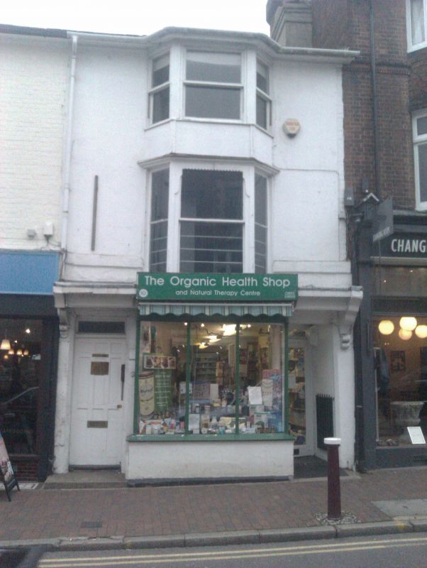
HIGH STREET
1.
1746
(North West Side)
No l0
TQ 5839 SW 2/216
II GV
2.
Mid C19. 3 storeys stuccoed. Slate roof. 1 3-light bay to all floors. Later
shop front. Included for group value.
Nos l0 to 14 (even) form a group.
Listing NGR: TQ5841439085
External links are from the relevant listing authority and, where applicable, Wikidata. Wikidata IDs may be related buildings as well as this specific building. If you want to add or update a link, you will need to do so by editing the Wikidata entry.


Other nearby listed buildings
