Approximate Location Map
Large Map »
Latitude: 51.1273 / 51°7'38"N
Longitude: 0.2627 / 0°15'45"E
OS Eastings: 558427
OS Northings: 138882
OS Grid: TQ584388
Mapcode National: GBR MPZ.76X
Mapcode Global: VHHQD.HXQP
Plus Code: 9F3247G7+W3
Entry Name: Grove Tavern
Listing Date: 7 June 1974
Grade: II
Source: Historic England
Source ID: 1084477
English Heritage Legacy ID: 168035
ID on this website: 101084477
Location: Royal Tunbridge Wells, Tunbridge Wells, Kent, TN1
County: Kent
District: Tunbridge Wells
Electoral Ward/Division: Pantiles and St Mark's
Parish: Non Civil Parish
Built-Up Area: Royal Tunbridge Wells
Traditional County: Kent
Lieutenancy Area (Ceremonial County): Kent
Church of England Parish: Tunbridge Wells Holy Trinity with Christ Church
Church of England Diocese: Rochester
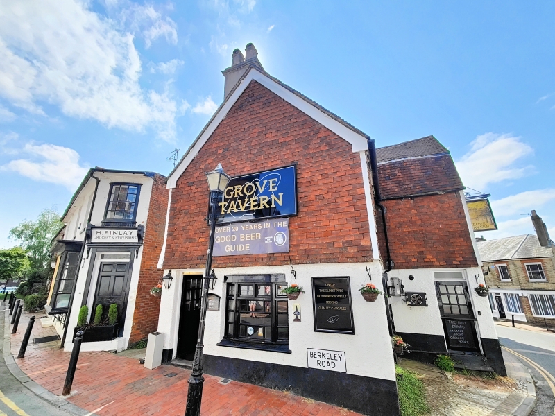
LITTLE MOUNT SION
1.
1746
(South Side)
No 34
(Grove Tavern)
TQ 5838 NW 1/239
II GV
2.
C18. L-shaped. The main part is of 2 storeys and attics tile hung with a pebble
dashed ground floor. Tiled mansard roof. 1 sash with glazing bars intact. Modern
bar fronts and door. The portion set back to the left is possibly later in date.
Tiled roof and 1 modern sash with glazing bars intact. Modern pub fronts. Cobbled
surface just outside door.
Nos 30 to 34 (even) form a group.
Listing NGR: TQ5843338879
External links are from the relevant listing authority and, where applicable, Wikidata. Wikidata IDs may be related buildings as well as this specific building. If you want to add or update a link, you will need to do so by editing the Wikidata entry.


Other nearby listed buildings
