Approximate Location Map
Large Map »
Latitude: 51.1367 / 51°8'12"N
Longitude: 0.2627 / 0°15'45"E
OS Eastings: 558395
OS Northings: 139925
OS Grid: TQ583399
Mapcode National: GBR MPS.M72
Mapcode Global: VHHQD.HPQG
Plus Code: 9F3247P7+M3
Entry Name: Grovsvenor Lodge
Listing Date: 7 June 1974
Grade: II
Source: Historic England
Source ID: 1084499
English Heritage Legacy ID: 167996
ID on this website: 101084499
Location: Royal Tunbridge Wells, Tunbridge Wells, Kent, TN1
County: Kent
District: Tunbridge Wells
Electoral Ward/Division: Culverden
Parish: Non Civil Parish
Built-Up Area: Royal Tunbridge Wells
Traditional County: Kent
Lieutenancy Area (Ceremonial County): Kent
Church of England Parish: Tunbridge Wells St John
Church of England Diocese: Rochester
Tagged with: Gatehouse
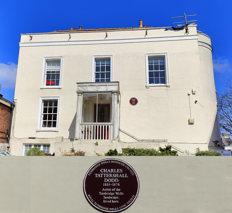
GROSVENOR ROAD
1.
1746
(North East Side)
No 72
(Grosvenor Lodge)
TQ 5839 NW 3/192 25.10.73.
II
2.
Circa 1820. 2 storeys stuccoed. Cornice and parapet. 3 windows facing west
and 3 facing south with glazing bars intact. Port cochere with Tuscan columns
on the west front. Curved bay of 2 windows on both floors of the south front.
Additions behind to east.
Listing NGR: TQ5839039926
External links are from the relevant listing authority and, where applicable, Wikidata. Wikidata IDs may be related buildings as well as this specific building. If you want to add or update a link, you will need to do so by editing the Wikidata entry.


Other nearby listed buildings
